Area Overview for WS13 6FG
Photos of WS13 6FG
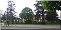
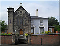
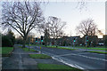
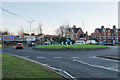
74 photos from this area
Area Information
Key information about the WS13 6FG including its size, population, and administrative classification.
- Area Type
- Postcode
- Area Size
- 1.9 hectares
- Population
- 1792
- Population Density
- 2166 people/km²
House Prices in WS13 6FG
62
Properties
£312,965
Average Sold Price
£128,876
Lowest Price
£690,000
Highest Price
Showing 62 properties
| Address | Type | Beds | Baths | Last Sale Price | Last Sale Date | |
|---|---|---|---|---|---|---|
| 1 Mary Slater Road, Lichfield, WS13 6FG | Detached | 4 | 3 | £690,000 | Sep 2025 | |
| 44 Mary Slater Road, Lichfield, WS13 6FG | house | - | - | £385,000 | Aug 2025 | |
| 65 Mary Slater Road, Lichfield, WS13 6FG | Semi-detached | 3 | 2 | £345,000 | Feb 2025 | |
| 63 Mary Slater Road, Lichfield, WS13 6FG | Terraced | 3 | 2 | £315,000 | Aug 2024 | |
| 18 Mary Slater Road, Lichfield, WS13 6FG | Terraced | 4 | 2 | £365,000 | Jul 2024 | |
| 22 Mary Slater Road, Lichfield, WS13 6FG | Semi-detached | 3 | 2 | £292,500 | Aug 2023 | |
| 19 Mary Slater Road, Lichfield, WS13 6FG | Detached | 1 | - | £205,000 | Mar 2023 | |
| 16 Mary Slater Road, Lichfield, WS13 6FG | house | - | - | £370,000 | Jul 2022 | |
| 21 Mary Slater Road, Lichfield, WS13 6FG | Terraced | 3 | 1 | £325,000 | Jun 2022 | |
| 5 Mary Slater Road, Lichfield, WS13 6FG | house | - | - | £515,000 | Jul 2021 |
Page 1 of 7
Energy Efficiency in WS13 6FG
Amenities
Schools
| Rank | School | Type | Entry gender | Ages |
|---|
Explore more schools in this area
Go to Schools tabDemographics
Household Size
One person
most common
Accommodation Type
Flats
most common
Tenure
57
majority
Ethnic Group
White
most common
Religion
N/A
most common
Household Composition
N/A
most common
Age
47
median
Elderly (65+ years)
most common
Household Deprivation
N/A
with no deprivation
NS-SEC
43
in Lower managerial occupations
Explore more demographic insights in this area
Go to Demographics tabPlanning
Planning Constraints
- Flood RiskPremium
- Ramsar Wetland SitesPremium
- Area of Outstanding Natural BeautyPremium
- Protected Nature ReservePremium
- Protected WoodlandPremium