Area Overview for WS13 6EW
Photos of WS13 6EW

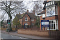
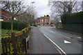
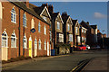
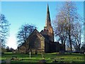
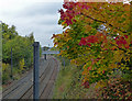
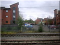
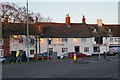
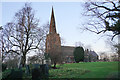


58 photos from this area
Area Information
Key information about the WS13 6EW including its size, population, and administrative classification.
- Area Type
- Postcode
- Area Size
- 1.3 hectares
- Population
- 1695
- Population Density
- 2185 people/km²
House Prices in WS13 6EW
16
Properties
£242,000
Average Sold Price
£89,000
Lowest Price
£470,000
Highest Price
Showing 16 properties
| Address | Type | Beds | Baths | Last Sale Price | Last Sale Date | |
|---|---|---|---|---|---|---|
| 55A Burton Old Road West, Lichfield, WS13 6EW | Bungalow | 3 | 2 | £470,000 | Oct 2024 | |
| 71 Burton Old Road West, Lichfield, WS13 6EW | Bungalow | 2 | - | £235,000 | Jun 2016 | |
| 72 Burton Old Road West, Lichfield, WS13 6EW | house | - | - | £410,000 | May 2016 | |
| 70 Burton Old Road West, Lichfield, WS13 6EW | house | - | - | £265,000 | Sep 2015 | |
| 63 Burton Old Road West, Lichfield, WS13 6EW | Detached | - | - | £220,000 | Oct 2006 | |
| 57 Burton Old Road West, Lichfield, WS13 6EW | Detached | - | - | £305,000 | Aug 2006 | |
| 61 Burton Old Road West, Lichfield, WS13 6EW | Detached | - | - | £171,000 | Mar 2002 | |
| 67 Burton Old Road West, Lichfield, WS13 6EW | Bungalow | 2 | 1 | £104,000 | Oct 2001 | |
| 65 Burton Old Road West, Lichfield, WS13 6EW | Detached | - | - | £89,000 | Mar 2000 | |
| 74 Burton Old Road West, Lichfield, WS13 6EW | Semi-detached | - | - | £151,000 | Jan 1998 |
Page 1 of 2
Energy Efficiency in WS13 6EW
Amenities
Schools
| Rank | School | Type | Entry gender | Ages |
|---|
Explore more schools in this area
Go to Schools tabDemographics
Household Size
One person
most common
Accommodation Type
Houses
most common
Tenure
72
majority
Ethnic Group
White
most common
Religion
N/A
most common
Household Composition
N/A
most common
Age
47
median
Adults (30-64 years)
most common
Household Deprivation
N/A
with no deprivation
NS-SEC
44
in Lower managerial occupations
Explore more demographic insights in this area
Go to Demographics tabPlanning
Planning Constraints
- Flood RiskPremium
- Ramsar Wetland SitesPremium
- Area of Outstanding Natural BeautyPremium
- Protected Nature ReservePremium
- Protected WoodlandPremium