Area Overview for WS12 3HF
Photos of WS12 3HF


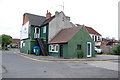
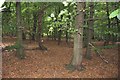
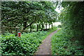
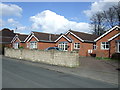
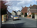
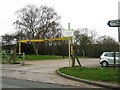
21 photos from this area
Area Information
Key information about the WS12 3HF including its size, population, and administrative classification.
- Area Type
- Postcode
- Area Size
- 1.5 hectares
- Population
- 1666
- Population Density
- 1653 people/km²
House Prices in WS12 3HF
39
Properties
£161,180
Average Sold Price
£28,500
Lowest Price
£358,000
Highest Price
Showing 39 properties
| Address | Type | Beds | Baths | Last Sale Price | Last Sale Date | |
|---|---|---|---|---|---|---|
| 234 Cannock Road, Heath Hayes, Cannock, WS12 3HF | Detached | 3 | 1 | £295,000 | Dec 2025 | |
| 232 Cannock Road, Heath Hayes, Cannock, WS12 3HF | Detached | 3 | 2 | £358,000 | Nov 2025 | |
| 144 Cannock Road, Heath Hayes, Cannock, WS12 3HF | Terraced | 3 | 1 | £165,000 | Aug 2025 | |
| 196 Cannock Road, Heath Hayes, Cannock, WS12 3HF | Semi-detached | 2 | 1 | £220,000 | Mar 2025 | |
| 180 Cannock Road, Heath Hayes, Cannock, WS12 3HF | house | 3 | 1 | £280,000 | May 2022 | |
| 198 Cannock Road, Heath Hayes, Cannock, WS12 3HF | house | - | - | £210,000 | Feb 2022 | |
| 230 Cannock Road, Heath Hayes, Cannock, WS12 3HF | house | - | - | £277,000 | Jun 2021 | |
| 224 Cannock Road, Heath Hayes, Cannock, WS12 3HF | Semi-detached | 2 | 1 | £150,000 | Apr 2019 | |
| 136 Cannock Road, Heath Hayes, Cannock, WS12 3HF | Semi-detached | 2 | 1 | £182,500 | Oct 2018 | |
| 200 Cannock Road, Heath Hayes, Cannock, WS12 3HF | house | - | - | £142,500 | Nov 2016 |
Page 1 of 4
Energy Efficiency in WS12 3HF
Amenities
Schools
| Rank | School | Type | Entry gender | Ages |
|---|
Explore more schools in this area
Go to Schools tabDemographics
Household Size
One person
most common
Accommodation Type
Houses
most common
Tenure
65
majority
Ethnic Group
White
most common
Religion
N/A
most common
Household Composition
N/A
most common
Age
47
median
Adults (30-64 years)
most common
Household Deprivation
N/A
with no deprivation
NS-SEC
26
in Lower managerial occupations
Explore more demographic insights in this area
Go to Demographics tabPlanning
Planning Constraints
- Flood RiskPremium
- Ramsar Wetland SitesPremium
- Area of Outstanding Natural BeautyPremium
- Protected Nature ReservePremium
- Protected WoodlandPremium