Area Overview for WS12 1NR
Photos of WS12 1NR
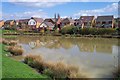
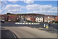
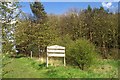
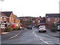
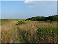
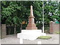


17 photos from this area
Area Information
Key information about the WS12 1NR including its size, population, and administrative classification.
- Area Type
- Postcode
- Area Size
- 5.5 hectares
- Population
- 1695
- Population Density
- 1147 people/km²
House Prices in WS12 1NR
21
Properties
-
Average Sold Price
-
Lowest Price
-
Highest Price
Showing 21 properties
| Address | Type | Beds | Baths | Last Sale Price | Last Sale Date | |
|---|---|---|---|---|---|---|
| Flat B, Chapel Heights, Littleworth Road, Cannock, WS12 1NR | Flat | - | - | - | - | |
| Flat A, Chapel Heights, Littleworth Road, Cannock, WS12 1NR | Flat | - | - | - | - | |
| Studio Flat, Chapel Heights, Littleworth Road, Cannock, WS12 1NR | Flat | - | - | - | - | |
| Unit 2, Anglesey Business Park, Littleworth Road, Cannock, WS12 1NR | general_industrial | - | - | - | - | |
| Office 110, Paget Court, Littleworth Road, Cannock, WS12 1NR | Office | - | - | - | - | |
| Pritchard Holdings Plc, Unit 24, Anglesey Business Park, Littleworth Road, Cannock, WS12 1NR | office_workshop | - | - | - | - | |
| Murray And Willis, Unit 25, Anglesey Business Park, Littleworth Road, Cannock, WS12 1NR | office_workshop | - | - | - | - | |
| Pritchard Group Holdings Ltd, Unit 23, Anglesey Business Park, Littleworth Road, Cannock, WS12 1NR | office_workshop | - | - | - | - | |
| Brookes Motors, Unit 26, Anglesey Business Park, Littleworth Road, Cannock, WS12 1NR | office_workshop | - | - | - | - | |
| Weedon Packaging Solution Centre Limited, Unit 4, Anglesey Business Park, Littleworth Road, Cannock, WS12 1NR | general_industrial | - | - | - | - |
Page 1 of 3
Energy Efficiency in WS12 1NR
Amenities
Schools
| Rank | School | Type | Entry gender | Ages |
|---|
Explore more schools in this area
Go to Schools tabDemographics
Household Size
Two person
most common
Accommodation Type
Houses
most common
Tenure
81
majority
Ethnic Group
White
most common
Religion
N/A
most common
Household Composition
N/A
most common
Age
47
median
Adults (30-64 years)
most common
Household Deprivation
N/A
with no deprivation
NS-SEC
33
in Lower managerial occupations
Explore more demographic insights in this area
Go to Demographics tabPlanning
Planning Constraints
- Flood RiskPremium
- Ramsar Wetland SitesPremium
- Area of Outstanding Natural BeautyPremium
- Protected Nature ReservePremium
- Protected WoodlandPremium