Area Overview for WS11 8JY
Photos of WS11 8JY
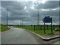
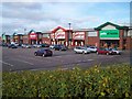
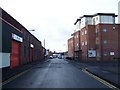
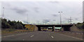
36 photos from this area
Area Information
Key information about the WS11 8JY including its size, population, and administrative classification.
- Area Type
- Postcode
- Area Size
- 1.8 hectares
- Population
- 1987
- Population Density
- 3359 people/km²
House Prices in WS11 8JY
16
Properties
£118,182
Average Sold Price
£40,000
Lowest Price
£205,000
Highest Price
Showing 16 properties
| Address | Type | Beds | Baths | Last Sale Price | Last Sale Date | |
|---|---|---|---|---|---|---|
| 21 Watling Street, Churchbridge, WS11 8JY | Semi-detached | 2 | 1 | £198,000 | Aug 2021 | |
| 19 Watling Street, Churchbridge, WS11 8JY | Semi-detached | 3 | 2 | £163,500 | Dec 2017 | |
| 18 Watling Street, Churchbridge, WS11 8JY | house | 2 | - | £117,500 | Sep 2015 | |
| 17 Watling Street, Churchbridge, WS11 8JY | house | - | - | £205,000 | Jan 2011 | |
| 20 Watling Street, Churchbridge, WS11 8JY | Semi-detached | - | - | £142,500 | Jul 2008 | |
| 23 Watling Street, Churchbridge, WS11 8JY | Semi-detached | - | - | £60,000 | Dec 2004 | |
| 15 Watling Street, Churchbridge, WS11 8JY | Detached | - | - | £126,000 | Aug 2004 | |
| 16 Watling Street, Churchbridge, WS11 8JY | Semi-detached | - | - | £112,500 | May 2004 | |
| 14 Watling Street, Churchbridge, WS11 8JY | Detached | - | - | £88,000 | Jan 2004 | |
| 22 Watling Street, Churchbridge, WS11 8JY | Detached | 2 | 1 | £40,000 | Mar 2002 |
Page 1 of 2
Energy Efficiency in WS11 8JY
Amenities
Schools
| Rank | School | Type | Entry gender | Ages |
|---|
Explore more schools in this area
Go to Schools tabDemographics
Household Size
Two person
most common
Accommodation Type
Houses
most common
Tenure
86
majority
Ethnic Group
White
most common
Religion
N/A
most common
Household Composition
N/A
most common
Age
47
median
Adults (30-64 years)
most common
Household Deprivation
N/A
with no deprivation
NS-SEC
36
in Lower managerial occupations
Explore more demographic insights in this area
Go to Demographics tabPlanning
Planning Constraints
- Flood RiskPremium
- Ramsar Wetland SitesPremium
- Area of Outstanding Natural BeautyPremium
- Protected Nature ReservePremium
- Protected WoodlandPremium