Area Overview for WS11 6UT
Photos of WS11 6UT


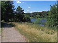
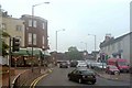
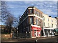
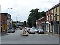
32 photos from this area
Area Information
Key information about the WS11 6UT including its size, population, and administrative classification.
- Area Type
- Postcode
- Area Size
- 1.9 hectares
- Population
- 1363
- Population Density
- 1516 people/km²
House Prices in WS11 6UT
43
Properties
£168,306
Average Sold Price
£46,000
Lowest Price
£334,000
Highest Price
Showing 43 properties
| Address | Type | Beds | Baths | Last Sale Price | Last Sale Date | |
|---|---|---|---|---|---|---|
| 56 Pebble Mill Drive, Blackfords, Cannock, WS11 6UT | Detached | 4 | 1 | £334,000 | Feb 2025 | |
| 48 Pebble Mill Drive, Blackfords, Cannock, WS11 6UT | house | - | - | £301,000 | Dec 2022 | |
| 10 Pebble Mill Drive, Blackfords, Cannock, WS11 6UT | Retail | 3 | 1 | £190,000 | Mar 2022 | |
| 58 Pebble Mill Drive, Blackfords, Cannock, WS11 6UT | house | 4 | - | £280,000 | Dec 2020 | |
| 14 Pebble Mill Drive, Blackfords, Cannock, WS11 6UT | Detached | 3 | 1 | £272,500 | Jul 2020 | |
| 50 Pebble Mill Drive, Blackfords, Cannock, WS11 6UT | Detached | 3 | 2 | £205,000 | Jan 2016 | |
| 1 Pebble Mill Drive, Blackfords, Cannock, WS11 6UT | Bungalow | 2 | - | £180,000 | Jan 2016 | |
| 9 Pebble Mill Drive, Blackfords, Cannock, WS11 6UT | Bungalow | 2 | - | £172,000 | Apr 2014 | |
| 26 Pebble Mill Drive, Blackfords, Cannock, WS11 6UT | Detached | 3 | - | £170,000 | Nov 2013 | |
| 21 Pebble Mill Drive, Blackfords, Cannock, WS11 6UT | Detached | - | - | £175,000 | Dec 2010 |
Page 1 of 5
Energy Efficiency in WS11 6UT
Amenities
Schools
| Rank | School | Type | Entry gender | Ages |
|---|
Explore more schools in this area
Go to Schools tabDemographics
Household Size
One person
most common
Accommodation Type
Houses
most common
Tenure
64
majority
Ethnic Group
White
most common
Religion
N/A
most common
Household Composition
N/A
most common
Age
47
median
Adults (30-64 years)
most common
Household Deprivation
N/A
with no deprivation
NS-SEC
26
in Lower managerial occupations
Explore more demographic insights in this area
Go to Demographics tabPlanning
Planning Constraints
- Flood RiskPremium
- Ramsar Wetland SitesPremium
- Area of Outstanding Natural BeautyPremium
- Protected Nature ReservePremium
- Protected WoodlandPremium