Area Overview for WS11 4PX
Photos of WS11 4PX
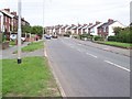
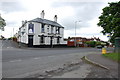
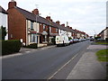
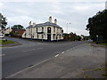


13 photos from this area
Area Information
Key information about the WS11 4PX including its size, population, and administrative classification.
- Area Type
- Postcode
- Area Size
- 2.3 hectares
- Population
- 1454
- Population Density
- 5369 people/km²
House Prices in WS11 4PX
49
Properties
£108,533
Average Sold Price
£37,000
Lowest Price
£173,000
Highest Price
Showing 49 properties
| Address | Type | Beds | Baths | Last Sale Price | Last Sale Date | |
|---|---|---|---|---|---|---|
| 9 Scotia Road, West Chadsmoor, Cannock, WS11 4PX | house | - | - | £150,000 | Dec 2022 | |
| 16 Scotia Road, West Chadsmoor, Cannock, WS11 4PX | house | - | - | £125,000 | May 2022 | |
| 10 Scotia Road, West Chadsmoor, Cannock, WS11 4PX | Semi-detached | 2 | - | £173,000 | Oct 2021 | |
| 8 Scotia Road, West Chadsmoor, Cannock, WS11 4PX | Semi-detached | 2 | 1 | £138,000 | Jul 2020 | |
| 28 Scotia Road, West Chadsmoor, Cannock, WS11 4PX | Semi-detached | 3 | 2 | £103,000 | Feb 2018 | |
| 38 Scotia Road, West Chadsmoor, Cannock, WS11 4PX | Semi-detached | 2 | 1 | £120,000 | Aug 2017 | |
| 52 Scotia Road, West Chadsmoor, Cannock, WS11 4PX | Semi-detached | 2 | 1 | £103,000 | Nov 2016 | |
| 21 Scotia Road, West Chadsmoor, Cannock, WS11 4PX | Semi-detached | 2 | 1 | £100,000 | Oct 2015 | |
| 5 Scotia Road, West Chadsmoor, Cannock, WS11 4PX | Semi-detached | 2 | 1 | £116,000 | Jul 2015 | |
| 3 Scotia Road, West Chadsmoor, Cannock, WS11 4PX | Semi-detached | 2 | 1 | £84,000 | Nov 2014 |
Page 1 of 5
Energy Efficiency in WS11 4PX
Amenities
Schools
| Rank | School | Type | Entry gender | Ages |
|---|
Explore more schools in this area
Go to Schools tabDemographics
Household Size
One person
most common
Accommodation Type
Houses
most common
Tenure
48
majority
Ethnic Group
White
most common
Religion
N/A
most common
Household Composition
N/A
most common
Age
47
median
Adults (30-64 years)
most common
Household Deprivation
N/A
with no deprivation
NS-SEC
15
in Lower managerial occupations
Explore more demographic insights in this area
Go to Demographics tabPlanning
Planning Constraints
- Flood RiskPremium
- Ramsar Wetland SitesPremium
- Area of Outstanding Natural BeautyPremium
- Protected Nature ReservePremium
- Protected WoodlandPremium