Area Overview for WS11 0EG
Photos of WS11 0EG


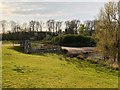
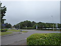
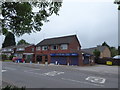
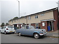
27 photos from this area
Area Information
Key information about the WS11 0EG including its size, population, and administrative classification.
- Area Type
- Postcode
- Area Size
- 1.8 hectares
- Population
- 1520
- Population Density
- 2814 people/km²
House Prices in WS11 0EG
31
Properties
£124,766
Average Sold Price
£46,000
Lowest Price
£170,000
Highest Price
Showing 31 properties
| Address | Type | Beds | Baths | Last Sale Price | Last Sale Date | |
|---|---|---|---|---|---|---|
| 11 Remington Drive, Cannock, WS11 0EG | Bungalow | 2 | 1 | £155,000 | May 2025 | |
| 17 Remington Drive, Cannock, WS11 0EG | Bungalow | 2 | 1 | £150,000 | Dec 2024 | |
| 26 Remington Drive, Cannock, WS11 0EG | Bungalow | 2 | 1 | £170,000 | Nov 2024 | |
| 6 Remington Drive, Cannock, WS11 0EG | Bungalow | 2 | 1 | £152,500 | Aug 2024 | |
| 16 Remington Drive, Cannock, WS11 0EG | Bungalow | 2 | 1 | £132,500 | Dec 2023 | |
| 13 Remington Drive, Cannock, WS11 0EG | Bungalow | 2 | 1 | £140,000 | Jun 2023 | |
| 12 Remington Drive, Cannock, WS11 0EG | Bungalow | 2 | 1 | £150,000 | Dec 2022 | |
| 15 Remington Drive, Cannock, WS11 0EG | Bungalow | 2 | 1 | £125,000 | Apr 2022 | |
| 22 Remington Drive, Cannock, WS11 0EG | Terraced | 2 | - | £135,000 | Apr 2022 | |
| 2 Remington Drive, Cannock, WS11 0EG | Bungalow | - | - | £122,000 | Jan 2022 |
Page 1 of 4
Energy Efficiency in WS11 0EG
Amenities
Schools
| Rank | School | Type | Entry gender | Ages |
|---|
Explore more schools in this area
Go to Schools tabDemographics
Household Size
One person
most common
Accommodation Type
Houses
most common
Tenure
53
majority
Ethnic Group
White
most common
Religion
N/A
most common
Household Composition
N/A
most common
Age
47
median
Adults (30-64 years)
most common
Household Deprivation
N/A
with no deprivation
NS-SEC
23
in Lower managerial occupations
Explore more demographic insights in this area
Go to Demographics tabPlanning
Planning Constraints
- Flood RiskPremium
- Ramsar Wetland SitesPremium
- Area of Outstanding Natural BeautyPremium
- Protected Nature ReservePremium
- Protected WoodlandPremium