Area Overview for WS11 0BY
Photos of WS11 0BY
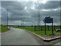
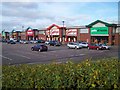
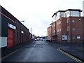


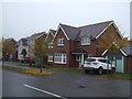
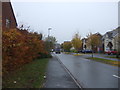
36 photos from this area
Area Information
Key information about the WS11 0BY including its size, population, and administrative classification.
- Area Type
- Postcode
- Area Size
- 1.0 hectares
- Population
- 2393
- Population Density
- 2370 people/km²
House Prices in WS11 0BY
42
Properties
£106,136
Average Sold Price
£15,000
Lowest Price
£175,000
Highest Price
Showing 42 properties
| Address | Type | Beds | Baths | Last Sale Price | Last Sale Date | |
|---|---|---|---|---|---|---|
| 20 Union Street, Bridgtown, Cannock, WS11 0BY | Terraced | 2 | 1 | £175,000 | Oct 2025 | |
| 33 Union Street, Bridgtown, Cannock, WS11 0BY | Semi-detached | 3 | 1 | £135,000 | Feb 2023 | |
| 46 Union Street, Bridgtown, Cannock, WS11 0BY | Terraced | 2 | 1 | £150,000 | Feb 2023 | |
| 18 Union Street, Bridgtown, Cannock, WS11 0BY | Terraced | 3 | 1 | £155,000 | Dec 2021 | |
| 54 Union Street, Bridgtown, Cannock, WS11 0BY | house | - | - | £135,000 | Jul 2021 | |
| 56 Union Street, Bridgtown, Cannock, WS11 0BY | Terraced | 2 | 1 | £138,000 | May 2021 | |
| 16 Union Street, Bridgtown, Cannock, WS11 0BY | Terraced | 3 | 1 | £145,000 | Jun 2020 | |
| 40 Union Street, Bridgtown, Cannock, WS11 0BY | house | - | - | £175,000 | Dec 2019 | |
| 45 Union Street, Bridgtown, Cannock, WS11 0BY | Terraced | 2 | 1 | £90,000 | Jun 2019 | |
| 3 Union Street, Bridgtown, Cannock, WS11 0BY | Semi-detached | 4 | 1 | £120,000 | Jan 2019 |
Page 1 of 5
Energy Efficiency in WS11 0BY
Amenities
Schools
| Rank | School | Type | Entry gender | Ages |
|---|
Explore more schools in this area
Go to Schools tabDemographics
Household Size
One person
most common
Accommodation Type
Houses
most common
Tenure
44
majority
Ethnic Group
White
most common
Religion
N/A
most common
Household Composition
N/A
most common
Age
47
median
Adults (30-64 years)
most common
Household Deprivation
N/A
with no deprivation
NS-SEC
25
in Lower managerial occupations
Explore more demographic insights in this area
Go to Demographics tabPlanning
Planning Constraints
- Flood RiskPremium
- Ramsar Wetland SitesPremium
- Area of Outstanding Natural BeautyPremium
- Protected Nature ReservePremium
- Protected WoodlandPremium