Area Overview for WS10 9DW
Photos of WS10 9DW
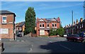
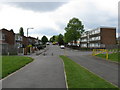
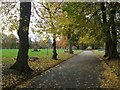
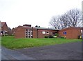

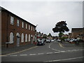
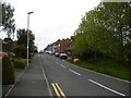
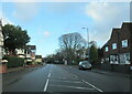
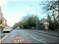
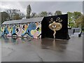
32 photos from this area
Area Information
Key information about the WS10 9DW including its size, population, and administrative classification.
- Area Type
- Postcode
- Area Size
- 1.2 hectares
- Population
- 1619
- Population Density
- 6749 people/km²
House Prices in WS10 9DW
46
Properties
£106,107
Average Sold Price
£17,000
Lowest Price
£240,000
Highest Price
Showing 46 properties
| Address | Type | Beds | Baths | Last Sale Price | Last Sale Date | |
|---|---|---|---|---|---|---|
| 27 Vicarage Road, Wednesbury, WS10 9DW | Terraced | 2 | 2 | £118,000 | Feb 2025 | |
| 94 Vicarage Road, Wednesbury, WS10 9DW | Detached | 3 | 1 | £240,000 | Jun 2022 | |
| 25 Vicarage Road, Wednesbury, WS10 9DW | house | - | - | £165,000 | Jun 2022 | |
| 56 Vicarage Road, Wednesbury, WS10 9DW | house | - | - | £129,000 | Mar 2022 | |
| 29 Vicarage Road, Wednesbury, WS10 9DW | Bungalow | 2 | 1 | £215,000 | Nov 2021 | |
| 54 Vicarage Road, Wednesbury, WS10 9DW | Terraced | 2 | 1 | £138,000 | Jan 2021 | |
| 82 Vicarage Road, Wednesbury, WS10 9DW | house | - | - | £65,000 | Jul 2019 | |
| 42 Vicarage Road, Wednesbury, WS10 9DW | house | - | - | £211,000 | Jul 2019 | |
| 50 Vicarage Road, Wednesbury, WS10 9DW | Terraced | 2 | 1 | £108,000 | Jun 2019 | |
| 76 Vicarage Road, Wednesbury, WS10 9DW | house | 3 | 1 | £135,000 | Jan 2019 |
Page 1 of 5
Energy Efficiency in WS10 9DW
Amenities
Schools
| Rank | School | Type | Entry gender | Ages |
|---|
Explore more schools in this area
Go to Schools tabDemographics
Household Size
Family (3-5 people)
most common
Accommodation Type
Houses
most common
Tenure
61
majority
Ethnic Group
White
most common
Religion
N/A
most common
Household Composition
N/A
most common
Age
47
median
Adults (30-64 years)
most common
Household Deprivation
N/A
with no deprivation
NS-SEC
19
in Lower managerial occupations
Explore more demographic insights in this area
Go to Demographics tabPlanning
Planning Constraints
- Flood RiskPremium
- Ramsar Wetland SitesPremium
- Area of Outstanding Natural BeautyPremium
- Protected Nature ReservePremium
- Protected WoodlandPremium