Area Overview for WS10 8UE
Photos of WS10 8UE
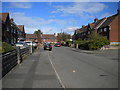
61 photos from this area
Area Information
Key information about the WS10 8UE including its size, population, and administrative classification.
- Area Type
- Postcode
- Area Size
- 4.2 hectares
- Population
- 1796
- Population Density
- 5114 people/km²
House Prices in WS10 8UE
42
Properties
£68,700
Average Sold Price
£17,500
Lowest Price
£150,000
Highest Price
Showing 42 properties
| Address | Type | Beds | Baths | Last Sale Price | Last Sale Date | |
|---|---|---|---|---|---|---|
| 101 Wolverhampton Street, Darlaston, WS10 8UE | house | 3 | 1 | £150,000 | Jul 2022 | |
| 95 Wolverhampton Street, Darlaston, WS10 8UE | Terraced | 3 | 1 | £90,000 | May 2022 | |
| 107 Wolverhampton Street, Darlaston, WS10 8UE | house | - | - | £95,000 | Aug 2020 | |
| 91 Wolverhampton Street, Darlaston, WS10 8UE | house | - | - | £100,000 | Mar 2020 | |
| 119 Wolverhampton Street, Darlaston, WS10 8UE | house | - | - | £100,000 | Dec 2018 | |
| 99 Wolverhampton Street, Darlaston, WS10 8UE | Terraced | 3 | 1 | £95,000 | Sep 2018 | |
| 93 Wolverhampton Street, Darlaston, WS10 8UE | house | - | - | £60,000 | Jun 2017 | |
| 89 Wolverhampton Street, Darlaston, WS10 8UE | house | 3 | - | £59,000 | Dec 2016 | |
| 117 Wolverhampton Street, Darlaston, WS10 8UE | house | - | - | £76,500 | Nov 2009 | |
| 97 Wolverhampton Street, Darlaston, WS10 8UE | house | - | - | £65,000 | Sep 2009 |
Page 1 of 5
Energy Efficiency in WS10 8UE
Amenities
Schools
| Rank | School | Type | Entry gender | Ages |
|---|
Explore more schools in this area
Go to Schools tabDemographics
Household Size
Family (3-5 people)
most common
Accommodation Type
Houses
most common
Tenure
42
majority
Ethnic Group
White
most common
Religion
N/A
most common
Household Composition
N/A
most common
Age
47
median
Adults (30-64 years)
most common
Household Deprivation
N/A
with no deprivation
NS-SEC
14
in Lower managerial occupations
Explore more demographic insights in this area
Go to Demographics tabPlanning
Planning Constraints
- Flood RiskPremium
- Ramsar Wetland SitesPremium
- Area of Outstanding Natural BeautyPremium
- Protected Nature ReservePremium
- Protected WoodlandPremium