Area Overview for WS10 8HU
Photos of WS10 8HU
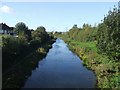
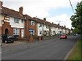
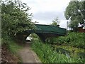
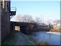

46 photos from this area
Area Information
Key information about the WS10 8HU including its size, population, and administrative classification.
- Area Type
- Postcode
- Area Size
- 1.4 hectares
- Population
- 1706
- Population Density
- 8474 people/km²
House Prices in WS10 8HU
42
Properties
£104,249
Average Sold Price
£57,995
Lowest Price
£161,000
Highest Price
Showing 42 properties
| Address | Type | Beds | Baths | Last Sale Price | Last Sale Date | |
|---|---|---|---|---|---|---|
| 181 Willenhall Street, Darlaston, WS10 8HU | house | 3 | 2 | £140,000 | Jun 2022 | |
| 146 Willenhall Street, Darlaston, WS10 8HU | Semi-detached | 3 | 1 | £161,000 | Dec 2021 | |
| 150 Willenhall Street, Darlaston, WS10 8HU | Terraced | - | - | £58,000 | Mar 2005 | |
| 168 Willenhall Street, Darlaston, WS10 8HU | house | - | - | £57,995 | Oct 2002 | |
| 176 Willenhall Street, Darlaston, WS10 8HU | Terraced | 3 | - | - | - | |
| 170 Willenhall Street, Darlaston, WS10 8HU | Terraced | - | - | - | - | |
| 148 Willenhall Street, Darlaston, WS10 8HU | house | - | - | - | - | |
| 132 Willenhall Street, Darlaston, WS10 8HU | Semi-detached | - | - | - | - | |
| 134 Willenhall Street, Darlaston, WS10 8HU | house | - | - | - | - | |
| 144 Willenhall Street, Darlaston, WS10 8HU | house | - | - | - | - |
Page 1 of 5
Energy Efficiency in WS10 8HU
Amenities
Schools
| Rank | School | Type | Entry gender | Ages |
|---|
Explore more schools in this area
Go to Schools tabDemographics
Household Size
Family (3-5 people)
most common
Accommodation Type
Houses
most common
Tenure
32
majority
Ethnic Group
White
most common
Religion
N/A
most common
Household Composition
N/A
most common
Age
47
median
Adults (30-64 years)
most common
Household Deprivation
N/A
with no deprivation
NS-SEC
11
in Lower managerial occupations
Explore more demographic insights in this area
Go to Demographics tabPlanning
Planning Constraints
- Flood RiskPremium
- Ramsar Wetland SitesPremium
- Area of Outstanding Natural BeautyPremium
- Protected Nature ReservePremium
- Protected WoodlandPremium