Area Overview for WS10 7QS
Photos of WS10 7QS

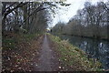
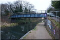
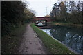
50 photos from this area
Area Information
Key information about the WS10 7QS including its size, population, and administrative classification.
- Area Type
- Postcode
- Area Size
- 1.6 hectares
- Population
- 1527
- Population Density
- 3918 people/km²
House Prices in WS10 7QS
34
Properties
£128,278
Average Sold Price
£60,000
Lowest Price
£225,000
Highest Price
Showing 34 properties
| Address | Type | Beds | Baths | Last Sale Price | Last Sale Date | |
|---|---|---|---|---|---|---|
| 82 Broadwaters Road, Darlaston, WS10 7QS | Detached | 3 | 1 | £225,000 | Jul 2025 | |
| 64 Broadwaters Road, Darlaston, WS10 7QS | Semi-detached | 3 | 1 | £165,000 | Jan 2025 | |
| 69 Broadwaters Road, Darlaston, WS10 7QS | house | - | - | £162,000 | Jul 2022 | |
| 63 Broadwaters Road, Darlaston, WS10 7QS | house | - | - | £150,000 | May 2022 | |
| 56 Broadwaters Road, Darlaston, WS10 7QS | Semi-detached | 3 | 1 | £172,000 | Aug 2021 | |
| 79 Broadwaters Road, Darlaston, WS10 7QS | house | 3 | - | £143,000 | Jan 2021 | |
| 90 Broadwaters Road, Darlaston, WS10 7QS | Semi-detached | 3 | 1 | £157,000 | Apr 2019 | |
| 84 Broadwaters Road, Darlaston, WS10 7QS | Semi-detached | 3 | 1 | £110,000 | Aug 2016 | |
| 65 Broadwaters Road, Darlaston, WS10 7QS | Semi-detached | 3 | 2 | £120,000 | Jun 2016 | |
| 88 Broadwaters Road, Darlaston, WS10 7QS | Semi-detached | 3 | 1 | £122,500 | Apr 2015 |
Page 1 of 4
Energy Efficiency in WS10 7QS
Amenities
Schools
| Rank | School | Type | Entry gender | Ages |
|---|
Explore more schools in this area
Go to Schools tabDemographics
Household Size
Family (3-5 people)
most common
Accommodation Type
Houses
most common
Tenure
49
majority
Ethnic Group
White
most common
Religion
N/A
most common
Household Composition
N/A
most common
Age
47
median
Adults (30-64 years)
most common
Household Deprivation
N/A
with no deprivation
NS-SEC
14
in Lower managerial occupations
Explore more demographic insights in this area
Go to Demographics tabPlanning
Planning Constraints
- Flood RiskPremium
- Ramsar Wetland SitesPremium
- Area of Outstanding Natural BeautyPremium
- Protected Nature ReservePremium
- Protected WoodlandPremium