Area Overview for WS1 4AZ
Photos of WS1 4AZ


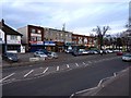
29 photos from this area
Area Information
Key information about the WS1 4AZ including its size, population, and administrative classification.
- Area Type
- Postcode
- Area Size
- 2.7 hectares
- Population
- 1851
- Population Density
- 7893 people/km²
House Prices in WS1 4AZ
53
Properties
£107,781
Average Sold Price
£32,000
Lowest Price
£238,000
Highest Price
Showing 53 properties
| Address | Type | Beds | Baths | Last Sale Price | Last Sale Date | |
|---|---|---|---|---|---|---|
| 128 Alexandra Road, Walsall, WS1 4AZ | house | - | - | £133,000 | Sep 2025 | |
| 102 Alexandra Road, Walsall, WS1 4AZ | Terraced | 3 | 1 | £200,000 | Apr 2024 | |
| 65 Alexandra Road, Walsall, WS1 4AZ | house | - | - | £235,000 | Jun 2023 | |
| 118 Alexandra Road, Walsall, WS1 4AZ | Detached | 4 | 2 | £185,000 | Feb 2023 | |
| 114 Alexandra Road, Walsall, WS1 4AZ | house | - | - | £100,000 | Sep 2021 | |
| 126 Alexandra Road, Walsall, WS1 4AZ | house | - | - | £135,700 | Aug 2021 | |
| 82 Alexandra Road, Walsall, WS1 4AZ | house | - | - | £238,000 | Jan 2021 | |
| 91 Alexandra Road, Walsall, WS1 4AZ | house | - | - | £125,000 | Sep 2019 | |
| 106 Alexandra Road, Walsall, WS1 4AZ | Semi-detached | 3 | - | £104,000 | Jan 2019 | |
| 109 Alexandra Road, Walsall, WS1 4AZ | Terraced | 3 | 1 | £136,000 | Nov 2018 |
Page 1 of 6
Energy Efficiency in WS1 4AZ
Amenities
Schools
| Rank | School | Type | Entry gender | Ages |
|---|
Explore more schools in this area
Go to Schools tabDemographics
Household Size
Family (3-5 people)
most common
Accommodation Type
Houses
most common
Tenure
49
majority
Ethnic Group
asian_total
most common
Religion
N/A
most common
Household Composition
N/A
most common
Age
47
median
Adults (30-64 years)
most common
Household Deprivation
N/A
with no deprivation
NS-SEC
15
in Lower managerial occupations
Explore more demographic insights in this area
Go to Demographics tabPlanning
Planning Constraints
- Flood RiskPremium
- Ramsar Wetland SitesPremium
- Area of Outstanding Natural BeautyPremium
- Protected Nature ReservePremium
- Protected WoodlandPremium