Area Overview for WS1 2QG
Photos of WS1 2QG
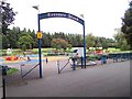
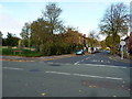
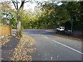
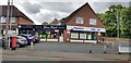
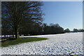
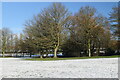
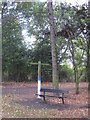
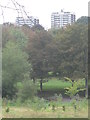
22 photos from this area
Area Information
Key information about the WS1 2QG including its size, population, and administrative classification.
- Area Type
- Postcode
- Area Size
- 1.6 hectares
- Population
- 1626
- Population Density
- 3760 people/km²
House Prices in WS1 2QG
48
Properties
£221,318
Average Sold Price
£59,000
Lowest Price
£325,000
Highest Price
Showing 48 properties
| Address | Type | Beds | Baths | Last Sale Price | Last Sale Date | |
|---|---|---|---|---|---|---|
| 11 Broadway North, Walsall, WS1 2QG | Semi-detached | 5 | 1 | £325,000 | May 2024 | |
| 35 Broadway North, Walsall, WS1 2QG | house | - | - | £288,500 | Sep 2021 | |
| 3 Broadway North, Walsall, WS1 2QG | house | - | - | £310,000 | Nov 2020 | |
| 21 Broadway North, Walsall, WS1 2QG | Semi-detached | 6 | - | £250,000 | Aug 2016 | |
| 17 Broadway North, Walsall, WS1 2QG | house | 4 | 2 | £250,000 | Sep 2015 | |
| 41 Broadway North, Walsall, WS1 2QG | Semi-detached | 5 | - | £217,000 | Dec 2013 | |
| 13 Broadway North, Walsall, WS1 2QG | house | - | - | £190,500 | Jun 2012 | |
| 7 Broadway North, Walsall, WS1 2QG | Semi-detached | 1 | 1 | £220,000 | May 2006 | |
| 39 Broadway North, Walsall, WS1 2QG | Semi-detached | - | - | £149,500 | Oct 2001 | |
| 31 Broadway North, Walsall, WS1 2QG | Semi-detached | - | - | £175,000 | Sep 2001 |
Page 1 of 5
Energy Efficiency in WS1 2QG
Amenities
Schools
| Rank | School | Type | Entry gender | Ages |
|---|
Explore more schools in this area
Go to Schools tabDemographics
Household Size
One person
most common
Accommodation Type
Houses
most common
Tenure
33
majority
Ethnic Group
White
most common
Religion
N/A
most common
Household Composition
N/A
most common
Age
47
median
Adults (30-64 years)
most common
Household Deprivation
N/A
with no deprivation
NS-SEC
23
in Lower managerial occupations
Explore more demographic insights in this area
Go to Demographics tabPlanning
Planning Constraints
- Flood RiskPremium
- Ramsar Wetland SitesPremium
- Area of Outstanding Natural BeautyPremium
- Protected Nature ReservePremium
- Protected WoodlandPremium