Area Overview for WS1 2PS
Photos of WS1 2PS
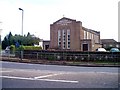
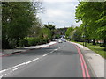
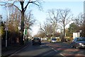
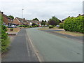
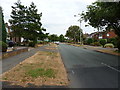

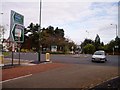
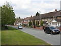
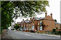
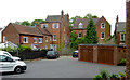
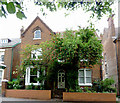
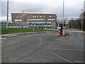
20 photos from this area
Area Information
Key information about the WS1 2PS including its size, population, and administrative classification.
- Area Type
- Postcode
- Area Size
- 2.1 hectares
- Population
- 1479
- Population Density
- 4428 people/km²
House Prices in WS1 2PS
23
Properties
£265,969
Average Sold Price
£105,000
Lowest Price
£500,000
Highest Price
Showing 23 properties
| Address | Type | Beds | Baths | Last Sale Price | Last Sale Date | |
|---|---|---|---|---|---|---|
| 269 Broadway North, Walsall, WS1 2PS | house | - | - | £500,000 | Nov 2024 | |
| 247 Broadway North, Walsall, WS1 2PS | house | - | - | £440,000 | Dec 2022 | |
| 263 Broadway North, Walsall, WS1 2PS | Detached | 4 | - | £295,000 | Feb 2015 | |
| 273 Broadway North, Walsall, WS1 2PS | house | 4 | - | £272,000 | Apr 2012 | |
| 265 Broadway North, Walsall, WS1 2PS | house | 4 | - | £364,500 | Dec 2011 | |
| 267 Broadway North, Walsall, WS1 2PS | house | - | - | £300,000 | Feb 2008 | |
| 267A Broadway North, Walsall, WS1 2PS | Detached | - | - | £277,000 | Aug 2007 | |
| 277 Broadway North, Walsall, WS1 2PS | Detached | - | - | £297,000 | Feb 2007 | |
| 251 Broadway North, Walsall, WS1 2PS | house | 4 | - | £310,000 | Nov 2003 | |
| 245 Broadway North, Walsall, WS1 2PS | Detached | - | - | £230,000 | Jul 2003 |
Page 1 of 3
Energy Efficiency in WS1 2PS
Amenities
Schools
| Rank | School | Type | Entry gender | Ages |
|---|
Explore more schools in this area
Go to Schools tabDemographics
Household Size
One person
most common
Accommodation Type
Flats
most common
Tenure
57
majority
Ethnic Group
White
most common
Religion
N/A
most common
Household Composition
N/A
most common
Age
47
median
Adults (30-64 years)
most common
Household Deprivation
N/A
with no deprivation
NS-SEC
28
in Lower managerial occupations
Explore more demographic insights in this area
Go to Demographics tabPlanning
Planning Constraints
- Flood RiskPremium
- Ramsar Wetland SitesPremium
- Area of Outstanding Natural BeautyPremium
- Protected Nature ReservePremium
- Protected WoodlandPremium