Area Overview for WR9 7HB
Photos of WR9 7HB
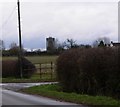
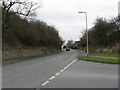
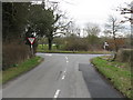
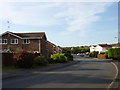
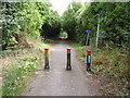
60 photos from this area
Area Information
Key information about the WR9 7HB including its size, population, and administrative classification.
- Area Type
- Postcode
- Area Size
- 3.4 hectares
- Population
- 1816
- Population Density
- 3445 people/km²
House Prices in WR9 7HB
57
Properties
£227,719
Average Sold Price
£125,000
Lowest Price
£397,000
Highest Price
Showing 57 properties
| Address | Type | Beds | Baths | Last Sale Price | Last Sale Date | |
|---|---|---|---|---|---|---|
| 50 Nightingale Close, Droitwich Spa, WR9 7HB | Detached | 3 | 2 | £370,000 | Sep 2025 | |
| 28 Nightingale Close, Droitwich Spa, WR9 7HB | Detached | 4 | 2 | £385,000 | Dec 2023 | |
| 54 Nightingale Close, Droitwich Spa, WR9 7HB | Detached | 4 | 2 | £397,000 | Jul 2023 | |
| 44 Nightingale Close, Droitwich Spa, WR9 7HB | Detached | 4 | 2 | £340,000 | Sep 2020 | |
| 26 Nightingale Close, Droitwich Spa, WR9 7HB | Detached | 3 | 2 | £270,500 | Jul 2020 | |
| 33 Nightingale Close, Droitwich Spa, WR9 7HB | Detached | 4 | 2 | £300,000 | Feb 2020 | |
| 29 Nightingale Close, Droitwich Spa, WR9 7HB | Detached | 4 | 2 | £298,000 | Jan 2019 | |
| 43 Nightingale Close, Droitwich Spa, WR9 7HB | Detached | 4 | 1 | £275,500 | May 2018 | |
| 14 Nightingale Close, Droitwich Spa, WR9 7HB | Detached | 3 | 1 | £265,000 | Jan 2018 | |
| 25 Nightingale Close, Droitwich Spa, WR9 7HB | house | 4 | - | £260,000 | Mar 2017 |
Page 1 of 6
Energy Efficiency in WR9 7HB
Amenities
Schools
| Rank | School | Type | Entry gender | Ages |
|---|
Explore more schools in this area
Go to Schools tabDemographics
Household Size
Family (3-5 people)
most common
Accommodation Type
Houses
most common
Tenure
75
majority
Ethnic Group
White
most common
Religion
N/A
most common
Household Composition
N/A
most common
Age
47
median
Adults (30-64 years)
most common
Household Deprivation
N/A
with no deprivation
NS-SEC
42
in Lower managerial occupations
Explore more demographic insights in this area
Go to Demographics tabPlanning
Planning Constraints
- Flood RiskPremium
- Ramsar Wetland SitesPremium
- Area of Outstanding Natural BeautyPremium
- Protected Nature ReservePremium
- Protected WoodlandPremium