Area Overview for WR9 0PX
Photos of WR9 0PX

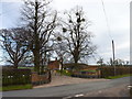
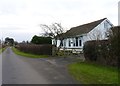
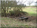
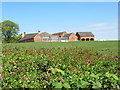
16 photos from this area
Area Information
Key information about the WR9 0PX including its size, population, and administrative classification.
- Area Type
- Postcode
- Area Size
- 72.6 hectares
- Population
- 2725
- Population Density
- 76 people/km²
House Prices in WR9 0PX
14
Properties
£748,333
Average Sold Price
£330,000
Lowest Price
£1,425,000
Highest Price
Showing 14 properties
| Address | Type | Beds | Baths | Last Sale Price | Last Sale Date | |
|---|---|---|---|---|---|---|
| 1, Bassage Cottages, Crown Lane To Mount Pleasant, Elmley Lovett, WR9 0PX | house | - | - | £490,000 | Mar 2025 | |
| Mount Pleasant, Crown Lane To Mount Pleasant, Elmley Lovett, WR9 0PX | Detached | 2 | 1 | £1,425,000 | Sep 2021 | |
| Bassage Farm, Crown Lane To Mount Pleasant, Elmley Lovett, WR9 0PX | house | - | - | £330,000 | Jul 2016 | |
| Valley Farm, Valley Lane, Elmley Lovett, WR9 0PX | house | - | - | - | - | |
| 2, Bassage Cottages, Crown Lane To Mount Pleasant, Elmley Lovett, WR9 0PX | house | - | - | - | - | |
| Ball Hill House, Crown Lane To Mount Pleasant, Elmley Lovett, WR9 0PX | Detached | - | - | - | - | |
| Upper Valley Farm, Valley Lane, Elmley Lovett, WR9 0PX | Farm | - | - | - | - | |
| The Hen House, Valley Farm, Valley Lane, Elmley Lovett, WR9 0PX | Detached | - | - | - | - | |
| No 2 Swallow Barns, Valley Farm, Valley Lane, Elmley Lovett, WR9 0PX | Bungalow | - | - | - | - | |
| No 1 Swallow Barns, Valley Farm, Valley Lane, Elmley Lovett, WR9 0PX | Semi-detached | 1 | 1 | - | - |
Page 1 of 2
Energy Efficiency in WR9 0PX
Amenities
Schools
| Rank | School | Type | Entry gender | Ages |
|---|
Explore more schools in this area
Go to Schools tabDemographics
Household Size
Two person
most common
Accommodation Type
Houses
most common
Tenure
77
majority
Ethnic Group
White
most common
Religion
N/A
most common
Household Composition
N/A
most common
Age
47
median
Adults (30-64 years)
most common
Household Deprivation
N/A
with no deprivation
NS-SEC
42
in Lower managerial occupations
Explore more demographic insights in this area
Go to Demographics tabPlanning
Planning Constraints
- Flood RiskPremium
- Ramsar Wetland SitesPremium
- Area of Outstanding Natural BeautyPremium
- Protected Nature ReservePremium
- Protected WoodlandPremium