Area Overview for WR9 0NF
Photos of WR9 0NF
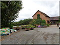
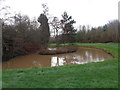
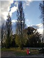
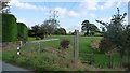
16 photos from this area
Area Information
Key information about the WR9 0NF including its size, population, and administrative classification.
- Area Type
- Postcode
- Area Size
- 48.9 hectares
- Population
- 2725
- Population Density
- 76 people/km²
House Prices in WR9 0NF
10
Properties
£754,000
Average Sold Price
£235,000
Lowest Price
£1,800,000
Highest Price
Showing 10 properties
| Address | Type | Beds | Baths | Last Sale Price | Last Sale Date | |
|---|---|---|---|---|---|---|
| Hinchley Farm, Rushock To Cutnall Green, Rushock, Cutnall Green, WR9 0NF | Detached | 7 | 4 | £1,800,000 | Aug 2025 | |
| Hinchley Farm Cottage, Rushock To Cutnall Green, Rushock, Cutnall Green, WR9 0NF | Cottage | 2 | 1 | £750,000 | Dec 2019 | |
| Old School House, Rushock To Cutnall Green, Rushock, Cutnall Green, WR9 0NF | Detached | 4 | - | £235,000 | Jul 2019 | |
| Cedarroofs, Rushock To Cutnall Green, Rushock, Cutnall Green, WR9 0NF | Land | 3 | 1 | £440,000 | Jun 2019 | |
| Bearcroft House, Clattercut Lane, Rushock, Droitwich Spa, WR9 0NF | house | - | - | £545,000 | Mar 2013 | |
| Bannut Tree Farm, Rushock To Cutnall Green, Rushock, Cutnall Green, WR9 0NF | Detached | - | - | - | - | |
| Bearcroft Cottage, Clattercut Lane, Rushock, Droitwich Spa, WR9 0NF | Semi-detached | - | - | - | - | |
| Annexe At, Hinchley Farm, Rushock To Cutnall Green, Rushock, Cutnall Green, WR9 0NF | Bungalow | - | - | - | - | |
| Parminter House, Rushock To Cutnall Green, Rushock, Cutnall Green, WR9 0NF | Detached | - | - | - | - | |
| Annexe At, Old School House, Rushock To Cutnall Green, Rushock, Cutnall Green, WR9 0NF | Flat | - | - | - | - |
Energy Efficiency in WR9 0NF
Amenities
Schools
| Rank | School | Type | Entry gender | Ages |
|---|
Explore more schools in this area
Go to Schools tabDemographics
Household Size
Two person
most common
Accommodation Type
Houses
most common
Tenure
77
majority
Ethnic Group
White
most common
Religion
N/A
most common
Household Composition
N/A
most common
Age
47
median
Adults (30-64 years)
most common
Household Deprivation
N/A
with no deprivation
NS-SEC
42
in Lower managerial occupations
Explore more demographic insights in this area
Go to Demographics tabPlanning
Planning Constraints
- Flood RiskPremium
- Ramsar Wetland SitesPremium
- Area of Outstanding Natural BeautyPremium
- Protected Nature ReservePremium
- Protected WoodlandPremium