Area Overview for WR8 9DH
Photos of WR8 9DH
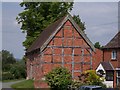
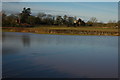
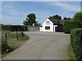
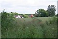

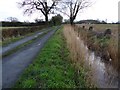
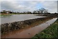
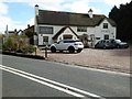
100 photos from this area
Area Information
Key information about the WR8 9DH including its size, population, and administrative classification.
- Area Type
- Postcode
- Area Size
- 88.9 hectares
- Population
- 1886
- Population Density
- 101 people/km²
House Prices in WR8 9DH
8
Properties
£527,500
Average Sold Price
£350,000
Lowest Price
£705,000
Highest Price
Showing 8 properties
| Address | Type | Beds | Baths | Last Sale Price | Last Sale Date | |
|---|---|---|---|---|---|---|
| The Willows, Pershore Road, Earls Croome, WR8 9DH | Detached | 5 | 3 | £705,000 | Oct 2022 | |
| Withybeds Cottage, Pershore Road, Earls Croome, WR8 9DH | Detached | 3 | 2 | £350,000 | Jul 2010 | |
| Moat Farm, Pershore Road, Earls Croome, WR8 9DH | Detached | 5 | 3 | - | - | |
| Annexe At, Moat Farm, Pershore Road, Earls Croome, WR8 9DH | house | 5 | 3 | - | - | |
| Moat Farm Barn, Pershore Road, Earls Croome, WR8 9DH | Detached | 5 | - | - | - | |
| Baughton Stud, Pershore Road, Earls Croome, WR8 9DH | Equestrian | - | - | - | - | |
| The Garden Lodge At, Withybeds Cottage, Pershore Road, Earls Croome, WR8 9DH | Flat | - | - | - | - | |
| Annexe At, Moat Farm Barn, Pershore Road, Earls Croome, WR8 9DH | Flat | - | - | - | - |
Energy Efficiency in WR8 9DH
Amenities
Schools
| Rank | School | Type | Entry gender | Ages |
|---|
Explore more schools in this area
Go to Schools tabDemographics
Household Size
Two person
most common
Accommodation Type
Houses
most common
Tenure
85
majority
Ethnic Group
White
most common
Religion
N/A
most common
Household Composition
N/A
most common
Age
47
median
Adults (30-64 years)
most common
Household Deprivation
N/A
with no deprivation
NS-SEC
43
in Lower managerial occupations
Explore more demographic insights in this area
Go to Demographics tabPlanning
Planning Constraints
- Flood RiskPremium
- Ramsar Wetland SitesPremium
- Area of Outstanding Natural BeautyPremium
- Protected Nature ReservePremium
- Protected WoodlandPremium