Area Overview for WR8 9BL
Photos of WR8 9BL
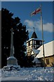
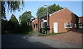
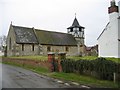
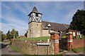

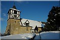
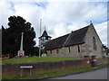
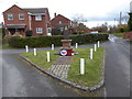
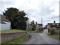
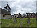
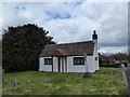
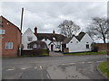
60 photos from this area
Area Information
Key information about the WR8 9BL including its size, population, and administrative classification.
- Area Type
- Postcode
- Area Size
- 28.0 hectares
- Population
- 1285
- Population Density
- 151 people/km²
House Prices in WR8 9BL
40
Properties
£362,579
Average Sold Price
£123,000
Lowest Price
£700,000
Highest Price
Showing 40 properties
| Address | Type | Beds | Baths | Last Sale Price | Last Sale Date | |
|---|---|---|---|---|---|---|
| Bredon View, Harpley Road, Defford, WR8 9BL | Semi-detached | 4 | 2 | £335,000 | Oct 2024 | |
| 1, Bank Cottage, Harpley Road, Defford, WR8 9BL | house | - | - | £245,000 | Sep 2024 | |
| 3, Freshfields, Harpley Road, Defford, WR8 9BL | Terraced | 3 | 2 | £307,500 | Nov 2022 | |
| Ashlea, Harpley Road, Defford, WR8 9BL | house | - | - | £370,000 | Oct 2019 | |
| Bank House, Harpley Road, Defford, WR8 9BL | house | - | - | £325,000 | Dec 2018 | |
| The Villa, Harpley Road, Defford, WR8 9BL | Detached | 4 | - | £352,000 | Jul 2018 | |
| Helderbank, Harpley Road, Defford, WR8 9BL | house | - | - | £475,000 | May 2018 | |
| Cannon Lodge, Harpley Road, Defford, WR8 9BL | house | - | - | £700,000 | Feb 2018 | |
| Polly Cottage, Harpley Road, Defford, WR8 9BL | house | - | - | £460,000 | Nov 2016 | |
| Cannon House, Harpley Road, Defford, WR8 9BL | Detached | - | - | £690,000 | Feb 2016 |
Page 1 of 4
Energy Efficiency in WR8 9BL
Amenities
Schools
| Rank | School | Type | Entry gender | Ages |
|---|
Explore more schools in this area
Go to Schools tabDemographics
Household Size
Two person
most common
Accommodation Type
Houses
most common
Tenure
86
majority
Ethnic Group
White
most common
Religion
N/A
most common
Household Composition
N/A
most common
Age
47
median
Adults (30-64 years)
most common
Household Deprivation
N/A
with no deprivation
NS-SEC
45
in Lower managerial occupations
Explore more demographic insights in this area
Go to Demographics tabPlanning
Planning Constraints
- Flood RiskPremium
- Ramsar Wetland SitesPremium
- Area of Outstanding Natural BeautyPremium
- Protected Nature ReservePremium
- Protected WoodlandPremium