Area Overview for WR8 0PJ
Photos of WR8 0PJ
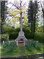
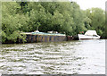
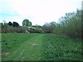
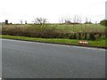
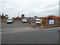

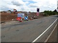
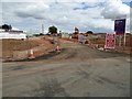
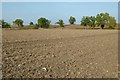
84 photos from this area
Area Information
Key information about the WR8 0PJ including its size, population, and administrative classification.
- Area Type
- Postcode
- Area Size
- 1.9 hectares
- Population
- 1886
- Population Density
- 101 people/km²
House Prices in WR8 0PJ
32
Properties
£256,583
Average Sold Price
£170,000
Lowest Price
£360,000
Highest Price
Showing 32 properties
| Address | Type | Beds | Baths | Last Sale Price | Last Sale Date | |
|---|---|---|---|---|---|---|
| 30 Ryall Meadow, Ryall, Upton Upon Severn, WR8 0PJ | Semi-detached | 3 | 1 | £283,000 | Mar 2025 | |
| 23 Ryall Meadow, Ryall, Upton Upon Severn, WR8 0PJ | Bungalow | 3 | 1 | £340,000 | Mar 2024 | |
| 12 Ryall Meadow, Ryall, Upton Upon Severn, WR8 0PJ | Bungalow | - | - | £240,000 | Dec 2022 | |
| 18 Ryall Meadow, Ryall, Upton Upon Severn, WR8 0PJ | Retail | 2 | 1 | £230,000 | Apr 2022 | |
| 10 Ryall Meadow, Ryall, Upton Upon Severn, WR8 0PJ | Semi-detached | 2 | 1 | £265,000 | Mar 2022 | |
| Dingle Dell, Ryall Meadow, Ryall, Upton Upon Severn, WR8 0PJ | Detached | 3 | 1 | £360,000 | Sep 2021 | |
| 22 Ryall Meadow, Ryall, Upton Upon Severn, WR8 0PJ | Bungalow | - | - | £340,000 | Jun 2021 | |
| Milestones, 15 Ryall Meadow, Ryall, Upton Upon Severn, WR8 0PJ | Semi-detached | 2 | - | £195,000 | Nov 2017 | |
| 9 Ryall Meadow, Ryall, Upton Upon Severn, WR8 0PJ | Bungalow | 2 | 1 | £230,000 | Jun 2017 | |
| 20 Ryall Meadow, Ryall, Upton Upon Severn, WR8 0PJ | Detached | 3 | - | £237,500 | Aug 2016 |
Page 1 of 4
Energy Efficiency in WR8 0PJ
Amenities
Schools
| Rank | School | Type | Entry gender | Ages |
|---|
Explore more schools in this area
Go to Schools tabDemographics
Household Size
Two person
most common
Accommodation Type
Houses
most common
Tenure
85
majority
Ethnic Group
White
most common
Religion
N/A
most common
Household Composition
N/A
most common
Age
47
median
Adults (30-64 years)
most common
Household Deprivation
N/A
with no deprivation
NS-SEC
43
in Lower managerial occupations
Explore more demographic insights in this area
Go to Demographics tabPlanning
Planning Constraints
- Flood RiskPremium
- Ramsar Wetland SitesPremium
- Area of Outstanding Natural BeautyPremium
- Protected Nature ReservePremium
- Protected WoodlandPremium