Area Overview for WR7 4RR
Photos of WR7 4RR

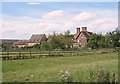
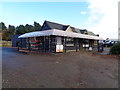
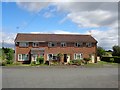
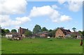
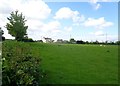
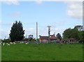
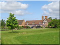
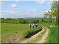
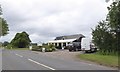
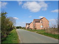
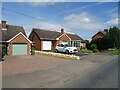
30 photos from this area
Area Information
Key information about the WR7 4RR including its size, population, and administrative classification.
- Area Type
- Postcode
- Area Size
- 43.8 hectares
- Population
- 1563
- Population Density
- 57 people/km²
House Prices in WR7 4RR
24
Properties
£373,500
Average Sold Price
£135,000
Lowest Price
£563,000
Highest Price
Showing 24 properties
| Address | Type | Beds | Baths | Last Sale Price | Last Sale Date | |
|---|---|---|---|---|---|---|
| The Old Stables, Windmill Lane, Stoulton, WR7 4RR | Semi-detached | 3 | 1 | £450,000 | Mar 2022 | |
| Woodlands, Windmill Lane, Stoulton, WR7 4RR | Bungalow | - | - | £455,000 | Mar 2022 | |
| Rosemary Cottage, Windmill Lane, Stoulton, WR7 4RR | Cottage | 4 | 2 | £401,000 | Oct 2020 | |
| Chestnut House, Windmill Lane, Stoulton, WR7 4RR | house | - | - | £420,000 | Feb 2020 | |
| Dormer House, Windmill Lane, Stoulton, WR7 4RR | Bungalow | - | - | £490,000 | Mar 2019 | |
| Meadow View, Windmill Lane, Stoulton, WR7 4RR | Bungalow | - | - | £245,000 | May 2018 | |
| Rose Cottage, Windmill Lane, Stoulton, WR7 4RR | house | - | - | £290,000 | Jul 2010 | |
| Thorndon Barn, Windmill Hill, Stoulton, WR7 4RR | Detached | 6 | 4 | £563,000 | May 2005 | |
| Thornwood, Windmill Hill, Stoulton, WR7 4RR | house | - | - | £286,000 | Dec 2002 | |
| Orchard Bungalow, Windmill Lane, Stoulton, WR7 4RR | Detached | - | - | £135,000 | Jul 2001 |
Page 1 of 3
Energy Efficiency in WR7 4RR
Amenities
Schools
| Rank | School | Type | Entry gender | Ages |
|---|
Explore more schools in this area
Go to Schools tabDemographics
Household Size
Two person
most common
Accommodation Type
Houses
most common
Tenure
73
majority
Ethnic Group
White
most common
Religion
N/A
most common
Household Composition
N/A
most common
Age
47
median
Adults (30-64 years)
most common
Household Deprivation
N/A
with no deprivation
NS-SEC
40
in Lower managerial occupations
Explore more demographic insights in this area
Go to Demographics tabPlanning
Planning Constraints
- Flood RiskPremium
- Ramsar Wetland SitesPremium
- Area of Outstanding Natural BeautyPremium
- Protected Nature ReservePremium
- Protected WoodlandPremium