Area Overview for WR5 3UX
Photos of WR5 3UX
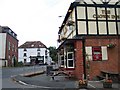
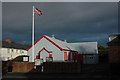
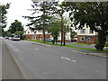
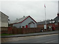
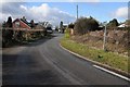
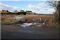
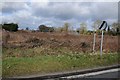
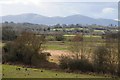
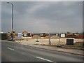
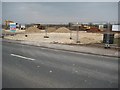
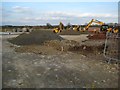
63 photos from this area
Area Information
Key information about the WR5 3UX including its size, population, and administrative classification.
- Area Type
- Postcode
- Area Size
- 1.7 hectares
- Population
- 2147
- Population Density
- 1040 people/km²
House Prices in WR5 3UX
49
Properties
£266,019
Average Sold Price
£185,000
Lowest Price
£410,000
Highest Price
Showing 49 properties
| Address | Type | Beds | Baths | Last Sale Price | Last Sale Date | |
|---|---|---|---|---|---|---|
| 22 Anglia Crescent, Kempsey, WR5 3UX | Semi-detached | 3 | 2 | £257,000 | Aug 2025 | |
| 17 Anglia Crescent, Kempsey, WR5 3UX | Detached | 3 | 2 | £310,000 | Mar 2022 | |
| 1 Anglia Crescent, Kempsey, WR5 3UX | Detached | 4 | 2 | £410,000 | Mar 2021 | |
| 5 Anglia Crescent, Kempsey, WR5 3UX | Semi-detached | 3 | 2 | £245,000 | Dec 2017 | |
| 3 Anglia Crescent, Kempsey, WR5 3UX | Semi-detached | 3 | 2 | £250,000 | Aug 2017 | |
| 54 Anglia Crescent, Kempsey, WR5 3UX | Detached | 3 | 2 | £265,000 | Sep 2016 | |
| 48 Anglia Crescent, Kempsey, WR5 3UX | house | - | - | £234,286 | Jul 2016 | |
| 4 Anglia Crescent, Kempsey, WR5 3UX | house | 3 | - | £263,900 | May 2016 | |
| 11 Anglia Crescent, Kempsey, WR5 3UX | Terraced | 2 | 1 | £185,000 | Mar 2016 | |
| 6 Anglia Crescent, Kempsey, WR5 3UX | house | - | - | £240,000 | Jan 2016 |
Page 1 of 5
Energy Efficiency in WR5 3UX
Amenities
Schools
| Rank | School | Type | Entry gender | Ages |
|---|
Explore more schools in this area
Go to Schools tabDemographics
Household Size
Two person
most common
Accommodation Type
Houses
most common
Tenure
76
majority
Ethnic Group
White
most common
Religion
N/A
most common
Household Composition
N/A
most common
Age
47
median
Adults (30-64 years)
most common
Household Deprivation
N/A
with no deprivation
NS-SEC
39
in Lower managerial occupations
Explore more demographic insights in this area
Go to Demographics tabPlanning
Planning Constraints
- Flood RiskPremium
- Ramsar Wetland SitesPremium
- Area of Outstanding Natural BeautyPremium
- Protected Nature ReservePremium
- Protected WoodlandPremium