Area Overview for WR5 3PT
Photos of WR5 3PT

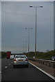

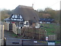
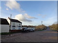
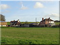
40 photos from this area
Area Information
Key information about the WR5 3PT including its size, population, and administrative classification.
- Area Type
- Postcode
- Area Size
- 12.3 hectares
- Population
- 2896
- Population Density
- 99 people/km²
House Prices in WR5 3PT
35
Properties
£360,447
Average Sold Price
£40,000
Lowest Price
£725,000
Highest Price
Showing 35 properties
| Address | Type | Beds | Baths | Last Sale Price | Last Sale Date | |
|---|---|---|---|---|---|---|
| 26 Napleton Lane, Kempsey, WR5 3PT | house | 4 | 2 | £500,000 | Oct 2024 | |
| 17 Napleton Lane, Kempsey, WR5 3PT | Bungalow | 2 | 1 | £310,000 | Apr 2024 | |
| Mill Cottage, 8 Napleton Lane, Kempsey, WR5 3PT | house | - | - | £725,000 | Aug 2022 | |
| 14 Napleton Lane, Kempsey, WR5 3PT | Retail | 4 | 1 | £392,000 | Mar 2022 | |
| 7 Napleton Lane, Kempsey, WR5 3PT | house | - | - | £358,000 | Feb 2022 | |
| 27 Napleton Lane, Kempsey, WR5 3PT | Detached | 4 | 2 | £390,000 | Nov 2019 | |
| Holmwood, Napleton Lane, Kempsey, WR5 3PT | Detached | 5 | 3 | £625,000 | Aug 2018 | |
| Holly House, Napleton Lane, Kempsey, WR5 3PT | Detached | 4 | 3 | £555,000 | Sep 2017 | |
| 4 Napleton Lane, Kempsey, WR5 3PT | Cottage | 3 | - | £355,000 | Nov 2016 | |
| 12 Napleton Lane, Kempsey, WR5 3PT | house | - | - | £280,000 | Aug 2016 |
Page 1 of 4
Energy Efficiency in WR5 3PT
Amenities
Schools
| Rank | School | Type | Entry gender | Ages |
|---|
Explore more schools in this area
Go to Schools tabDemographics
Household Size
Two person
most common
Accommodation Type
Houses
most common
Tenure
78
majority
Ethnic Group
White
most common
Religion
N/A
most common
Household Composition
N/A
most common
Age
47
median
Adults (30-64 years)
most common
Household Deprivation
N/A
with no deprivation
NS-SEC
42
in Lower managerial occupations
Explore more demographic insights in this area
Go to Demographics tabPlanning
Planning Constraints
- Flood RiskPremium
- Ramsar Wetland SitesPremium
- Area of Outstanding Natural BeautyPremium
- Protected Nature ReservePremium
- Protected WoodlandPremium