Area Overview for WR5 2QB
Photos of WR5 2QB
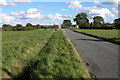
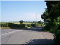
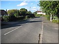
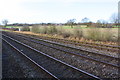
33 photos from this area
Area Information
Key information about the WR5 2QB including its size, population, and administrative classification.
- Area Type
- Postcode
- Area Size
- 18.5 hectares
- Population
- 2367
- Population Density
- 220 people/km²
House Prices in WR5 2QB
21
Properties
£295,938
Average Sold Price
£78,500
Lowest Price
£475,000
Highest Price
Showing 21 properties
| Address | Type | Beds | Baths | Last Sale Price | Last Sale Date | |
|---|---|---|---|---|---|---|
| Field Cottage, 64A Wadborough Road, Littleworth, WR5 2QB | Retail | 3 | 2 | £265,000 | Mar 2021 | |
| 68 Wadborough Road, Littleworth, WR5 2QB | Detached | 4 | 2 | £475,000 | Jul 2018 | |
| Solitaire, 66 Wadborough Road, Littleworth, WR5 2QB | Bungalow | - | - | £400,000 | Oct 2016 | |
| Oakmont, Wadborough Road, Littleworth, WR5 2QB | house | 4 | - | £460,000 | Aug 2012 | |
| Rose Cottage, 64 Wadborough Road, Littleworth, WR5 2QB | Semi-detached | - | - | £174,000 | Mar 2008 | |
| 62 Wadborough Road, Littleworth, WR5 2QB | Detached | - | - | £350,000 | Nov 2006 | |
| 72 Wadborough Road, Littleworth, WR5 2QB | Detached | 4 | 2 | £165,000 | Jul 2003 | |
| 70 Wadborough Road, Littleworth, WR5 2QB | Detached | - | - | £78,500 | Nov 1996 | |
| Woodview, Wadborough Road, Littleworth, WR5 2QB | house | 5 | 4 | - | - | |
| Sewage Works, Wadborough Road, Littleworth, WR5 2QB | Industrial | - | - | - | - |
Page 1 of 3
Energy Efficiency in WR5 2QB
Amenities
Schools
| Rank | School | Type | Entry gender | Ages |
|---|
Explore more schools in this area
Go to Schools tabDemographics
Household Size
Two person
most common
Accommodation Type
Houses
most common
Tenure
73
majority
Ethnic Group
White
most common
Religion
N/A
most common
Household Composition
N/A
most common
Age
47
median
Adults (30-64 years)
most common
Household Deprivation
N/A
with no deprivation
NS-SEC
43
in Lower managerial occupations
Explore more demographic insights in this area
Go to Demographics tabPlanning
Planning Constraints
- Flood RiskPremium
- Ramsar Wetland SitesPremium
- Area of Outstanding Natural BeautyPremium
- Protected Nature ReservePremium
- Protected WoodlandPremium