Area Overview for WR5 2AL
Photos of WR5 2AL

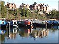
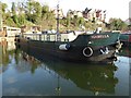
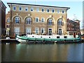
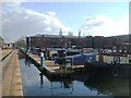
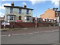
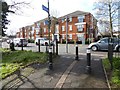
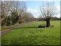
100 photos from this area
Area Information
Key information about the WR5 2AL including its size, population, and administrative classification.
- Area Type
- Postcode
- Area Size
- 1.6 hectares
- Population
- 1704
- Population Density
- 5761 people/km²
House Prices in WR5 2AL
23
Properties
£191,629
Average Sold Price
£58,000
Lowest Price
£370,000
Highest Price
Showing 23 properties
| Address | Type | Beds | Baths | Last Sale Price | Last Sale Date | |
|---|---|---|---|---|---|---|
| 19 St Audries Road, Worcester, WR5 2AL | Semi-detached | 3 | 1 | £360,000 | Aug 2023 | |
| 10 St Audries Road, Worcester, WR5 2AL | Semi-detached | - | - | £127,000 | Mar 2023 | |
| 11 St Audries Road, Worcester, WR5 2AL | Detached | 3 | 1 | £370,000 | Jun 2022 | |
| 27 St Audries Road, Worcester, WR5 2AL | house | 4 | 2 | £271,000 | May 2018 | |
| 12 St Audries Road, Worcester, WR5 2AL | Detached | 3 | 3 | £235,000 | Oct 2013 | |
| 4 St Audries Road, Worcester, WR5 2AL | Semi-detached | 3 | - | £215,000 | Oct 2013 | |
| 14 St Audries Road, Worcester, WR5 2AL | Detached | 3 | - | £183,000 | Mar 2013 | |
| 23 St Audries Road, Worcester, WR5 2AL | Semi-detached | 3 | 1 | £170,000 | Feb 2010 | |
| 13 St Audries Road, Worcester, WR5 2AL | Detached | - | - | £312,750 | Nov 2005 | |
| 3 St Audries Road, Worcester, WR5 2AL | Semi-detached | - | - | £165,000 | May 2004 |
Page 1 of 3
Energy Efficiency in WR5 2AL
Amenities
Schools
| Rank | School | Type | Entry gender | Ages |
|---|
Explore more schools in this area
Go to Schools tabDemographics
Household Size
Family (3-5 people)
most common
Accommodation Type
Houses
most common
Tenure
65
majority
Ethnic Group
White
most common
Religion
N/A
most common
Household Composition
N/A
most common
Age
47
median
Adults (30-64 years)
most common
Household Deprivation
N/A
with no deprivation
NS-SEC
44
in Lower managerial occupations
Explore more demographic insights in this area
Go to Demographics tabPlanning
Planning Constraints
- Flood RiskPremium
- Ramsar Wetland SitesPremium
- Area of Outstanding Natural BeautyPremium
- Protected Nature ReservePremium
- Protected WoodlandPremium