Area Overview for WR5 1RU
Photos of WR5 1RU
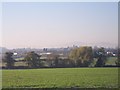


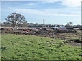
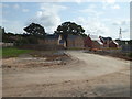

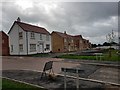
81 photos from this area
Area Information
Key information about the WR5 1RU including its size, population, and administrative classification.
- Area Type
- Postcode
- Area Size
- 53.8 hectares
- Population
- 1525
- Population Density
- 54 people/km²
House Prices in WR5 1RU
24
Properties
£440,821
Average Sold Price
£229,500
Lowest Price
£950,000
Highest Price
Showing 24 properties
| Address | Type | Beds | Baths | Last Sale Price | Last Sale Date | |
|---|---|---|---|---|---|---|
| Cornmill House, Spetchley Road, Spetchley, WR5 1RU | house | 5 | 3 | £950,000 | Oct 2025 | |
| Hill House, Swinesherd Lane, Spetchley, WR5 1RU | house | - | - | £616,250 | Aug 2021 | |
| Country Lodge, Swinesherd, Worcester, WR5 1RU | Detached | - | - | £550,000 | Aug 2019 | |
| Avenue Cottage, Swinesherd, Worcester, WR5 1RU | house | - | - | £245,000 | Mar 2012 | |
| 5, Cornmill Barns, Spetchley Road, Spetchley, WR5 1RU | storage_distribution | - | - | £250,000 | Nov 2003 | |
| 6, Cornmill Barns, Spetchley Road, Spetchley, WR5 1RU | Semi-detached | 4 | - | £229,500 | May 2002 | |
| Poplar Cottage, Swinesherd, Worcester, WR5 1RU | Detached | - | - | £245,000 | Feb 2001 | |
| Hollybush Cottage, Swinesherd, Worcester, WR5 1RU | Detached | 3 | 2 | - | - | |
| Homeleigh, Spetchley Road, Spetchley, WR5 1RU | Bungalow | 3 | 1 | - | - | |
| Richards Keep, Spetchley Road, Spetchley, WR5 1RU | undefined | - | - | - | - |
Page 1 of 3
Energy Efficiency in WR5 1RU
Amenities
Schools
| Rank | School | Type | Entry gender | Ages |
|---|
Explore more schools in this area
Go to Schools tabDemographics
Household Size
Two person
most common
Accommodation Type
Houses
most common
Tenure
76
majority
Ethnic Group
White
most common
Religion
N/A
most common
Household Composition
N/A
most common
Age
47
median
Adults (30-64 years)
most common
Household Deprivation
N/A
with no deprivation
NS-SEC
44
in Lower managerial occupations
Explore more demographic insights in this area
Go to Demographics tabPlanning
Planning Constraints
- Flood RiskPremium
- Ramsar Wetland SitesPremium
- Area of Outstanding Natural BeautyPremium
- Protected Nature ReservePremium