Area Overview for WR4 9QN
Photos of WR4 9QN

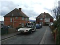
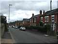
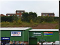

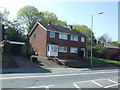
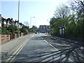
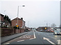
100 photos from this area
Area Information
Key information about the WR4 9QN including its size, population, and administrative classification.
- Area Type
- Postcode
- Area Size
- 9746 m²
- Population
- 1325
- Population Density
- 4313 people/km²
House Prices in WR4 9QN
40
Properties
£132,200
Average Sold Price
£100,000
Lowest Price
£175,500
Highest Price
Showing 40 properties
| Address | Type | Beds | Baths | Last Sale Price | Last Sale Date | |
|---|---|---|---|---|---|---|
| 123 Rose Avenue, Tolladine, Worcester, WR4 9QN | house | 3 | - | £175,500 | Jan 2021 | |
| 129 Rose Avenue, Tolladine, Worcester, WR4 9QN | house | - | - | £126,501 | Nov 2018 | |
| 141 Rose Avenue, Tolladine, Worcester, WR4 9QN | Semi-detached | 3 | - | £124,000 | Mar 2016 | |
| 127 Rose Avenue, Tolladine, Worcester, WR4 9QN | house | - | - | £100,000 | Apr 2009 | |
| 137 Rose Avenue, Tolladine, Worcester, WR4 9QN | Semi-detached | - | - | £135,000 | Mar 2008 | |
| 171 Rose Avenue, Tolladine, Worcester, WR4 9QN | Flat | 3 | 1 | - | - | |
| Former Flat At, 159 Rose Avenue, Tolladine, Worcester, WR4 9QN | Flat | - | - | - | - | |
| Former Flat At, 157 Rose Avenue, Tolladine, Worcester, WR4 9QN | Flat | - | - | - | - | |
| Flat At, 155 Rose Avenue, Tolladine, Worcester, WR4 9QN | Flat | - | - | - | - | |
| Former Flat At, 161 Rose Avenue, Tolladine, Worcester, WR4 9QN | Flat | - | - | - | - |
Page 1 of 4
Energy Efficiency in WR4 9QN
Amenities
Schools
| Rank | School | Type | Entry gender | Ages |
|---|
Explore more schools in this area
Go to Schools tabDemographics
Household Size
Family (3-5 people)
most common
Accommodation Type
Houses
most common
Tenure
36
majority
Ethnic Group
White
most common
Religion
N/A
most common
Household Composition
N/A
most common
Age
47
median
Adults (30-64 years)
most common
Household Deprivation
N/A
with no deprivation
NS-SEC
19
in Lower managerial occupations
Explore more demographic insights in this area
Go to Demographics tabPlanning
Planning Constraints
- Flood RiskPremium
- Ramsar Wetland SitesPremium
- Area of Outstanding Natural BeautyPremium
- Protected Nature ReservePremium
- Protected WoodlandPremium