Area Overview for WR3 8DY
Photos of WR3 8DY
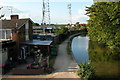
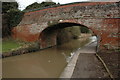
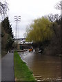
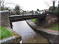
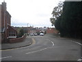
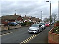
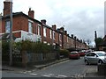

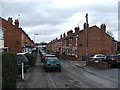
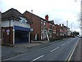
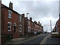
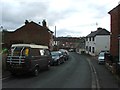
91 photos from this area
Area Information
Key information about the WR3 8DY including its size, population, and administrative classification.
- Area Type
- Postcode
- Area Size
- 7593 m²
- Population
- 2126
- Population Density
- 5367 people/km²
House Prices in WR3 8DY
27
Properties
£169,000
Average Sold Price
£45,000
Lowest Price
£300,000
Highest Price
Showing 27 properties
| Address | Type | Beds | Baths | Last Sale Price | Last Sale Date | |
|---|---|---|---|---|---|---|
| Brynley, 45 Longfellow Road, Worcester, WR3 8DY | Terraced | 3 | 1 | £300,000 | Nov 2024 | |
| 35 Longfellow Road, Worcester, WR3 8DY | house | - | - | £260,000 | Oct 2022 | |
| 47 Longfellow Road, Worcester, WR3 8DY | Terraced | 3 | 1 | £215,000 | Dec 2017 | |
| 17 Longfellow Road, Worcester, WR3 8DY | house | - | - | £170,000 | Jul 2013 | |
| 27 Longfellow Road, Worcester, WR3 8DY | house | - | - | £170,000 | Dec 2009 | |
| 21 Longfellow Road, Worcester, WR3 8DY | house | - | - | £163,000 | Jul 2009 | |
| 1 Longfellow Road, Worcester, WR3 8DY | house | - | - | £125,000 | Aug 2008 | |
| 5 Longfellow Road, Worcester, WR3 8DY | Terraced | 3 | 1 | £140,000 | Jul 2008 | |
| 25 Longfellow Road, Worcester, WR3 8DY | Semi-detached | 3 | 2 | £180,000 | Oct 2007 | |
| 3 Longfellow Road, Worcester, WR3 8DY | Terraced | 3 | - | £91,000 | Dec 2001 |
Page 1 of 3
Energy Efficiency in WR3 8DY
Amenities
Schools
| Rank | School | Type | Entry gender | Ages |
|---|
Explore more schools in this area
Go to Schools tabDemographics
Household Size
One person
most common
Accommodation Type
Houses
most common
Tenure
67
majority
Ethnic Group
White
most common
Religion
N/A
most common
Household Composition
N/A
most common
Age
47
median
Adults (30-64 years)
most common
Household Deprivation
N/A
with no deprivation
NS-SEC
40
in Lower managerial occupations
Explore more demographic insights in this area
Go to Demographics tabPlanning
Planning Constraints
- Flood RiskPremium
- Ramsar Wetland SitesPremium
- Area of Outstanding Natural BeautyPremium
- Protected Nature ReservePremium
- Protected WoodlandPremium