Area Overview for WR3 7DT
Photos of WR3 7DT
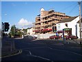
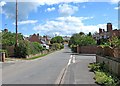

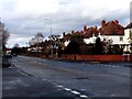
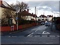
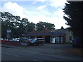
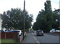


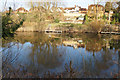
59 photos from this area
Area Information
Key information about the WR3 7DT including its size, population, and administrative classification.
- Area Type
- Postcode
- Area Size
- 6138 m²
- Population
- 1558
- Population Density
- 5803 people/km²
House Prices in WR3 7DT
19
Properties
£204,713
Average Sold Price
£100,000
Lowest Price
£392,500
Highest Price
Showing 19 properties
| Address | Type | Beds | Baths | Last Sale Price | Last Sale Date | |
|---|---|---|---|---|---|---|
| 48 Northwick Road, Worcester, WR3 7DT | Terraced | 2 | 1 | £230,000 | Jun 2025 | |
| 60 Northwick Road, Worcester, WR3 7DT | Terraced | 2 | 1 | £159,000 | Feb 2021 | |
| 52 Northwick Road, Worcester, WR3 7DT | Terraced | 2 | - | £197,700 | Sep 2018 | |
| 59 Northwick Road, Worcester, WR3 7DT | Semi-detached | 3 | 2 | £258,500 | Jun 2018 | |
| 57 Northwick Road, Worcester, WR3 7DT | house | - | - | £256,500 | May 2018 | |
| 55 Northwick Road, Worcester, WR3 7DT | Semi-detached | 4 | 2 | £258,500 | May 2018 | |
| 61 Northwick Road, Worcester, WR3 7DT | Semi-detached | 3 | 2 | £256,500 | May 2018 | |
| 53 Northwick Road, Worcester, WR3 7DT | house | - | - | £392,500 | Apr 2018 | |
| 56 Northwick Road, Worcester, WR3 7DT | Terraced | 2 | - | £112,500 | Apr 2014 | |
| 44 Northwick Road, Worcester, WR3 7DT | Semi-detached | 4 | - | £230,000 | Aug 2013 |
Page 1 of 2
Energy Efficiency in WR3 7DT
Amenities
Schools
| Rank | School | Type | Entry gender | Ages |
|---|
Explore more schools in this area
Go to Schools tabDemographics
Household Size
One person
most common
Accommodation Type
Houses
most common
Tenure
64
majority
Ethnic Group
White
most common
Religion
N/A
most common
Household Composition
N/A
most common
Age
47
median
Adults (30-64 years)
most common
Household Deprivation
N/A
with no deprivation
NS-SEC
40
in Lower managerial occupations
Explore more demographic insights in this area
Go to Demographics tabPlanning
Planning Constraints
- Flood RiskPremium
- Ramsar Wetland SitesPremium
- Area of Outstanding Natural BeautyPremium
- Protected Nature ReservePremium
- Protected WoodlandPremium