Area Overview for WR2 5TF
Photos of WR2 5TF
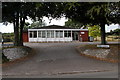
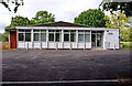
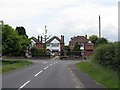
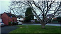
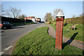
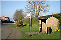
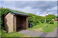
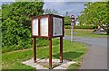
21 photos from this area
Area Information
Key information about the WR2 5TF including its size, population, and administrative classification.
- Area Type
- Postcode
- Area Size
- 3.4 hectares
- Population
- 2382
- Population Density
- 109 people/km²
House Prices in WR2 5TF
13
Properties
£234,958
Average Sold Price
£163,000
Lowest Price
£315,000
Highest Price
Showing 13 properties
| Address | Type | Beds | Baths | Last Sale Price | Last Sale Date | |
|---|---|---|---|---|---|---|
| The Ivy, Coronation Avenue, Rushwick, WR2 5TF | house | - | - | £315,000 | May 2022 | |
| 7 Coronation Avenue, Rushwick, WR2 5TF | Semi-detached | 4 | 1 | £315,000 | Sep 2021 | |
| 9 Coronation Avenue, Rushwick, WR2 5TF | Semi-detached | 3 | 1 | £255,000 | Aug 2021 | |
| 5 Coronation Avenue, Rushwick, WR2 5TF | house | 2 | 1 | £235,000 | Dec 2020 | |
| 8 Coronation Avenue, Rushwick, WR2 5TF | Semi-detached | 4 | 1 | £310,000 | Oct 2020 | |
| 6 Coronation Avenue, Rushwick, WR2 5TF | house | - | - | £222,500 | Feb 2020 | |
| 2 Coronation Avenue, Rushwick, WR2 5TF | Semi-detached | 3 | 1 | £235,000 | Dec 2016 | |
| 10 Coronation Avenue, Rushwick, WR2 5TF | house | 3 | - | £215,000 | Jan 2016 | |
| St Annes, 3 Coronation Avenue, Rushwick, WR2 5TF | house | 2 | - | £190,000 | Apr 2011 | |
| 4 Coronation Avenue, Rushwick, WR2 5TF | Detached | 2 | 1 | £187,000 | Dec 2007 |
Page 1 of 2
Energy Efficiency in WR2 5TF
Amenities
Schools
| Rank | School | Type | Entry gender | Ages |
|---|
Explore more schools in this area
Go to Schools tabDemographics
Household Size
Two person
most common
Accommodation Type
Houses
most common
Tenure
86
majority
Ethnic Group
White
most common
Religion
N/A
most common
Household Composition
N/A
most common
Age
47
median
Adults (30-64 years)
most common
Household Deprivation
N/A
with no deprivation
NS-SEC
43
in Lower managerial occupations
Explore more demographic insights in this area
Go to Demographics tabPlanning
Planning Constraints
- Flood RiskPremium
- Ramsar Wetland SitesPremium
- Area of Outstanding Natural BeautyPremium
- Protected Nature ReservePremium
- Protected WoodlandPremium