Area Overview for WR2 5EN
Photos of WR2 5EN

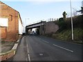

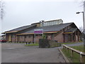
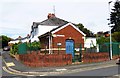
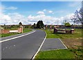

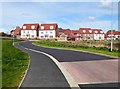
57 photos from this area
Area Information
Key information about the WR2 5EN including its size, population, and administrative classification.
- Area Type
- Postcode
- Area Size
- 5813 m²
- Population
- 2680
- Population Density
- 2602 people/km²
House Prices in WR2 5EN
17
Properties
£176,000
Average Sold Price
£115,000
Lowest Price
£310,000
Highest Price
Showing 17 properties
| Address | Type | Beds | Baths | Last Sale Price | Last Sale Date | |
|---|---|---|---|---|---|---|
| 24 Whitmore Road, Worcester, WR2 5EN | Semi-detached | 3 | 2 | £310,000 | Dec 2024 | |
| 24A Whitmore Road, Worcester, WR2 5EN | Bungalow | 2 | 2 | £290,000 | Dec 2024 | |
| 18 Whitmore Road, Worcester, WR2 5EN | Terraced | 2 | 1 | £149,000 | Jul 2024 | |
| 12 Whitmore Road, Worcester, WR2 5EN | Terraced | 2 | 1 | £165,000 | Jun 2021 | |
| 8 Whitmore Road, Worcester, WR2 5EN | house | 2 | - | £125,000 | Nov 2018 | |
| 22 Whitmore Road, Worcester, WR2 5EN | house | 2 | - | £121,000 | Sep 2012 | |
| 4 Whitmore Road, Worcester, WR2 5EN | house | - | - | £133,000 | Nov 2009 | |
| 16 Whitmore Road, Worcester, WR2 5EN | Detached | 5 | 2 | £115,000 | Sep 2003 | |
| 28 Whitmore Road, Worcester, WR2 5EN | Terraced | 2 | - | - | - | |
| 32 Whitmore Road, Worcester, WR2 5EN | Semi-detached | - | - | - | - |
Page 1 of 2
Energy Efficiency in WR2 5EN
Amenities
Schools
| Rank | School | Type | Entry gender | Ages |
|---|
Explore more schools in this area
Go to Schools tabDemographics
Household Size
Family (3-5 people)
most common
Accommodation Type
Houses
most common
Tenure
67
majority
Ethnic Group
White
most common
Religion
N/A
most common
Household Composition
N/A
most common
Age
47
median
Adults (30-64 years)
most common
Household Deprivation
N/A
with no deprivation
NS-SEC
35
in Lower managerial occupations
Explore more demographic insights in this area
Go to Demographics tabPlanning
Planning Constraints
- Flood RiskPremium
- Ramsar Wetland SitesPremium
- Area of Outstanding Natural BeautyPremium
- Protected Nature ReservePremium
- Protected WoodlandPremium