Area Overview for WR2 4QN
Photos of WR2 4QN
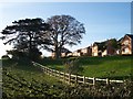
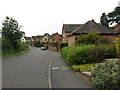
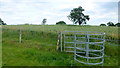
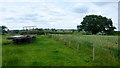
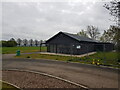


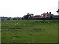
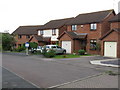
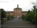
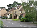

19 photos from this area
Area Information
Key information about the WR2 4QN including its size, population, and administrative classification.
- Area Type
- Postcode
- Area Size
- 1.4 hectares
- Population
- 1861
- Population Density
- 327 people/km²
House Prices in WR2 4QN
16
Properties
£190,053
Average Sold Price
£64,950
Lowest Price
£535,000
Highest Price
Showing 16 properties
| Address | Type | Beds | Baths | Last Sale Price | Last Sale Date | |
|---|---|---|---|---|---|---|
| 17 Berry Close, Powick, WR2 4QN | house | - | - | £360,000 | Apr 2025 | |
| 11 Berry Close, Powick, WR2 4QN | house | - | - | £535,000 | Dec 2022 | |
| 9 Berry Close, Powick, WR2 4QN | Detached | 4 | 3 | £438,000 | Jun 2020 | |
| 14 Berry Close, Powick, WR2 4QN | Terraced | 3 | 1 | £182,000 | Mar 2019 | |
| 4 Berry Close, Powick, WR2 4QN | Semi-detached | 3 | - | £175,000 | Sep 2016 | |
| 2 Berry Close, Powick, WR2 4QN | house | 2 | - | £145,000 | Jul 2012 | |
| 6 Berry Close, Powick, WR2 4QN | Detached | 4 | 2 | £197,000 | Jan 2006 | |
| 12 Berry Close, Powick, WR2 4QN | Detached | - | - | £206,000 | Dec 2005 | |
| 1 Berry Close, Powick, WR2 4QN | Terraced | - | - | £168,000 | Dec 2004 | |
| 15 Berry Close, Powick, WR2 4QN | Terraced | - | - | £104,950 | Sep 2002 |
Page 1 of 2
Energy Efficiency in WR2 4QN
Amenities
Schools
| Rank | School | Type | Entry gender | Ages |
|---|
Explore more schools in this area
Go to Schools tabDemographics
Household Size
Two person
most common
Accommodation Type
Houses
most common
Tenure
82
majority
Ethnic Group
White
most common
Religion
N/A
most common
Household Composition
N/A
most common
Age
47
median
Adults (30-64 years)
most common
Household Deprivation
N/A
with no deprivation
NS-SEC
46
in Lower managerial occupations
Explore more demographic insights in this area
Go to Demographics tabPlanning
Planning Constraints
- Flood RiskPremium
- Ramsar Wetland SitesPremium
- Area of Outstanding Natural BeautyPremium
- Protected Nature ReservePremium
- Protected WoodlandPremium