Area Overview for WR2 4PZ
Photos of WR2 4PZ
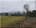
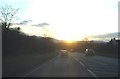
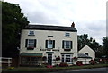
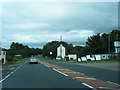
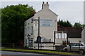
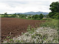
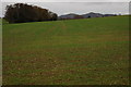
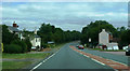
19 photos from this area
Area Information
Key information about the WR2 4PZ including its size, population, and administrative classification.
- Area Type
- Postcode
- Area Size
- 2.3 hectares
- Population
- 1861
- Population Density
- 327 people/km²
House Prices in WR2 4PZ
17
Properties
£253,912
Average Sold Price
£30,000
Lowest Price
£437,050
Highest Price
Showing 17 properties
| Address | Type | Beds | Baths | Last Sale Price | Last Sale Date | |
|---|---|---|---|---|---|---|
| The Wick, 10 Prince Rupert Avenue, Powick, WR2 4PZ | house | - | - | £437,050 | Feb 2019 | |
| 9 Prince Rupert Avenue, Powick, WR2 4PZ | Detached | 4 | 2 | £348,000 | Jun 2018 | |
| 21 Prince Rupert Avenue, Powick, WR2 4PZ | Detached | 4 | 2 | £355,000 | Aug 2017 | |
| 8 Prince Rupert Avenue, Powick, WR2 4PZ | house | - | - | £350,000 | Jun 2017 | |
| 25 Prince Rupert Avenue, Powick, WR2 4PZ | house | - | - | £394,950 | Jun 2016 | |
| 12 Prince Rupert Avenue, Powick, WR2 4PZ | Detached | 4 | - | £330,000 | Aug 2014 | |
| 7 Prince Rupert Avenue, Powick, WR2 4PZ | Detached | 4 | - | £280,000 | Feb 2014 | |
| 27 Prince Rupert Avenue, Powick, WR2 4PZ | house | - | - | £278,000 | Mar 2012 | |
| 15 Prince Rupert Avenue, Powick, WR2 4PZ | Detached | - | - | £250,000 | Apr 2006 | |
| 14 Prince Rupert Avenue, Powick, WR2 4PZ | Detached | - | - | £325,000 | Jun 2005 |
Page 1 of 2
Energy Efficiency in WR2 4PZ
Amenities
Schools
| Rank | School | Type | Entry gender | Ages |
|---|
Explore more schools in this area
Go to Schools tabDemographics
Household Size
Two person
most common
Accommodation Type
Houses
most common
Tenure
82
majority
Ethnic Group
White
most common
Religion
N/A
most common
Household Composition
N/A
most common
Age
47
median
Adults (30-64 years)
most common
Household Deprivation
N/A
with no deprivation
NS-SEC
46
in Lower managerial occupations
Explore more demographic insights in this area
Go to Demographics tabPlanning
Planning Constraints
- Flood RiskPremium
- Ramsar Wetland SitesPremium
- Area of Outstanding Natural BeautyPremium
- Protected Nature ReservePremium
- Protected WoodlandPremium