Area Overview for WR15 8JH
Photos of WR15 8JH

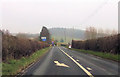
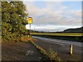
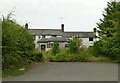
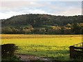
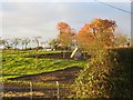
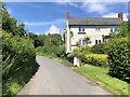

14 photos from this area
Area Information
Key information about the WR15 8JH including its size, population, and administrative classification.
- Area Type
- Postcode
- Area Size
- 77.9 hectares
- Population
- 2294
- Population Density
- 54 people/km²
House Prices in WR15 8JH
35
Properties
£264,125
Average Sold Price
£30,000
Lowest Price
£390,000
Highest Price
Showing 35 properties
| Address | Type | Beds | Baths | Last Sale Price | Last Sale Date | |
|---|---|---|---|---|---|---|
| Selridge, Dumbleton Lane, Eardiston, WR15 8JH | Detached | 4 | 2 | £354,000 | Jul 2019 | |
| Cullen House, A 443 Eardiston, Eardiston, WR15 8JH | Detached | 4 | 2 | £390,000 | Sep 2017 | |
| The Lodge, A 443 Eardiston, Eardiston, WR15 8JH | Land | 3 | 2 | £282,500 | Mar 2015 | |
| Orchard House, A 443 Eardiston, Eardiston, WR15 8JH | Detached | 5 | 2 | £30,000 | Nov 2002 | |
| Highfield, 48 A 443 Eardiston, Eardiston, WR15 8JH | Detached | 3 | 1 | - | - | |
| Flat 2, Eardiston House, A 443 Eardiston, Eardiston, WR15 8JH | Flat | 3 | 1 | - | - | |
| Flat 4, Eardiston House, A 443 Eardiston, Eardiston, WR15 8JH | Terraced | 1 | 1 | - | - | |
| Flat 6, Eardiston House, A 443 Eardiston, Eardiston, WR15 8JH | Flat | 2 | 1 | - | - | |
| Flat 1, Eardiston House, A 443 Eardiston, Eardiston, WR15 8JH | Semi-detached | 3 | 1 | - | - | |
| 1, Hopkilns, A 443 Eardiston, Eardiston, WR15 8JH | Semi-detached | 3 | 1 | - | - |
Page 1 of 4
Energy Efficiency in WR15 8JH
Amenities
Schools
| Rank | School | Type | Entry gender | Ages |
|---|
Explore more schools in this area
Go to Schools tabDemographics
Household Size
Two person
most common
Accommodation Type
Houses
most common
Tenure
80
majority
Ethnic Group
White
most common
Religion
N/A
most common
Household Composition
N/A
most common
Age
47
median
Adults (30-64 years)
most common
Household Deprivation
N/A
with no deprivation
NS-SEC
40
in Lower managerial occupations
Explore more demographic insights in this area
Go to Demographics tabPlanning
Planning Constraints
- Flood RiskPremium
- Ramsar Wetland SitesPremium
- Area of Outstanding Natural BeautyPremium
- Protected Nature ReservePremium
- Protected WoodlandPremium