Area Overview for WR14 4EQ
Photos of WR14 4EQ
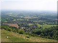
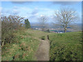
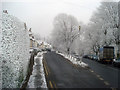
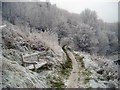
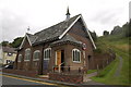
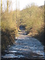
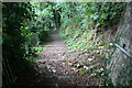
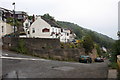
124 photos from this area
Area Information
Key information about the WR14 4EQ including its size, population, and administrative classification.
- Area Type
- Postcode
- Area Size
- 9361 m²
- Population
- 1484
- Population Density
- 58 people/km²
House Prices in WR14 4EQ
15
Properties
£326,000
Average Sold Price
£120,000
Lowest Price
£780,000
Highest Price
Showing 15 properties
| Address | Type | Beds | Baths | Last Sale Price | Last Sale Date | |
|---|---|---|---|---|---|---|
| 74A Wyche Road, Malvern, WR14 4EQ | Flat | - | - | £500,000 | Feb 2025 | |
| 80 Wyche Road, Malvern, WR14 4EQ | Maisonette | 3 | 2 | £780,000 | Sep 2024 | |
| Lantern Cottage, 88 Wyche Road, Malvern, WR14 4EQ | Semi-detached | 2 | 1 | £165,000 | Jun 2018 | |
| Upalong, 78 Wyche Road, Malvern, WR14 4EQ | house | - | - | £330,000 | Apr 2018 | |
| 82 Wyche Road, Malvern, WR14 4EQ | Flat | - | - | £175,000 | Mar 2007 | |
| Westerhan House, 92 Wyche Road, Malvern, WR14 4EQ | Detached | - | - | £212,000 | Apr 2003 | |
| Shangri La, 90 Wyche Road, Malvern, WR14 4EQ | house | - | - | £120,000 | Jun 2002 | |
| Malvern Cottage Annexe At, Shangri La, 90 Wyche Road, Malvern, WR14 4EQ | Detached | 1 | 1 | - | - | |
| Top Flat, 80 Wyche Road, Malvern, WR14 4EQ | Flat | - | - | - | - | |
| Top Flat At, The Wyche Inn, 74 Wyche Road, Malvern, WR14 4EQ | hotel | - | - | - | - |
Page 1 of 2
Energy Efficiency in WR14 4EQ
Amenities
Schools
| Rank | School | Type | Entry gender | Ages |
|---|
Explore more schools in this area
Go to Schools tabDemographics
Household Size
Two person
most common
Accommodation Type
Houses
most common
Tenure
83
majority
Ethnic Group
White
most common
Religion
N/A
most common
Household Composition
N/A
most common
Age
47
median
Adults (30-64 years)
most common
Household Deprivation
N/A
with no deprivation
NS-SEC
49
in Lower managerial occupations
Explore more demographic insights in this area
Go to Demographics tabPlanning
Planning Constraints
- Flood RiskPremium
- Ramsar Wetland SitesPremium
- Area of Outstanding Natural BeautyPremium
- Protected Nature ReservePremium
- Protected WoodlandPremium