Area Overview for WR14 3QP
Photos of WR14 3QP
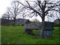
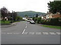
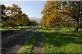
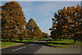
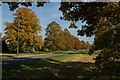
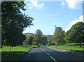
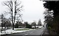
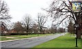
96 photos from this area
Area Information
Key information about the WR14 3QP including its size, population, and administrative classification.
- Area Type
- Postcode
- Area Size
- 2.1 hectares
- Population
- 1690
- Population Density
- 3982 people/km²
House Prices in WR14 3QP
14
Properties
£523,480
Average Sold Price
£292,400
Lowest Price
£755,000
Highest Price
Showing 14 properties
| Address | Type | Beds | Baths | Last Sale Price | Last Sale Date | |
|---|---|---|---|---|---|---|
| 44 Guarlford Road, Malvern, WR14 3QP | Detached | 5 | 2 | £685,000 | Oct 2024 | |
| The Elms, 52 Guarlford Road, Malvern, WR14 3QP | Detached | 5 | 2 | £755,000 | Jun 2024 | |
| 42 Guarlford Road, Malvern, WR14 3QP | Bungalow | 3 | - | £390,000 | Nov 2018 | |
| 18 Guarlford Road, Malvern, WR14 3QP | Detached | 4 | - | £495,000 | May 2014 | |
| 16 Guarlford Road, Malvern, WR14 3QP | Detached | 3 | - | £292,400 | Mar 2010 | |
| Teannta, 24A Guarlford Road, Malvern, WR14 3QP | Detached | 5 | 2 | - | - | |
| Mill Farm, 28 Guarlford Road, Malvern, WR14 3QP | Detached | 7 | 1 | - | - | |
| Owners Accommodation At, Bluebell Inn, 4 Guarlford Road, Malvern, WR14 3QP | Flat | - | - | - | - | |
| Bed And Breakfast At, Treherne House, 54 Guarlford Road, Malvern, WR14 3QP | hotel | - | - | - | - | |
| Bed And Breakfast At, The Elms, 52 Guarlford Road, Malvern, WR14 3QP | hotel | - | - | - | - |
Page 1 of 2
Energy Efficiency in WR14 3QP
Amenities
Schools
| Rank | School | Type | Entry gender | Ages |
|---|
Explore more schools in this area
Go to Schools tabDemographics
Household Size
One person
most common
Accommodation Type
Houses
most common
Tenure
52
majority
Ethnic Group
White
most common
Religion
N/A
most common
Household Composition
N/A
most common
Age
47
median
Adults (30-64 years)
most common
Household Deprivation
N/A
with no deprivation
NS-SEC
29
in Lower managerial occupations
Explore more demographic insights in this area
Go to Demographics tabPlanning
Planning Constraints
- Flood RiskPremium
- Ramsar Wetland SitesPremium
- Area of Outstanding Natural BeautyPremium
- Protected Nature ReservePremium
- Protected WoodlandPremium