Area Overview for WR14 3PY
Photos of WR14 3PY
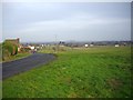
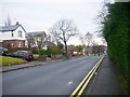
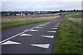
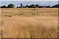
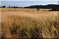
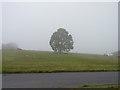
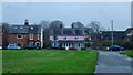
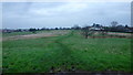
100 photos from this area
Area Information
Key information about the WR14 3PY including its size, population, and administrative classification.
- Area Type
- Postcode
- Area Size
- 9920 m²
- Population
- 1463
- Population Density
- 1339 people/km²
House Prices in WR14 3PY
19
Properties
£212,279
Average Sold Price
£88,000
Lowest Price
£340,000
Highest Price
Showing 19 properties
| Address | Type | Beds | Baths | Last Sale Price | Last Sale Date | |
|---|---|---|---|---|---|---|
| 14 St Bernard Drive, Malvern, WR14 3PY | Bungalow | 3 | - | £340,000 | May 2018 | |
| 16 St Bernard Drive, Malvern, WR14 3PY | Bungalow | 3 | 2 | £279,950 | Jun 2017 | |
| 17 St Bernard Drive, Malvern, WR14 3PY | Bungalow | 3 | 2 | £260,000 | Dec 2015 | |
| 22 St Bernard Drive, Malvern, WR14 3PY | Detached | - | - | £188,000 | Jun 2009 | |
| 18 St Bernard Drive, Malvern, WR14 3PY | house | - | - | £170,000 | May 2009 | |
| 12 St Bernard Drive, Malvern, WR14 3PY | Detached | - | - | £160,000 | Feb 2006 | |
| 15 St Bernard Drive, Malvern, WR14 3PY | Detached | - | - | £88,000 | Nov 1999 | |
| 2 St Bernard Drive, Malvern, WR14 3PY | Detached | 3 | 1 | - | - | |
| 8 St Bernard Drive, Malvern, WR14 3PY | Detached | 4 | 3 | - | - | |
| 1 St Bernard Drive, Malvern, WR14 3PY | Bungalow | 3 | 1 | - | - |
Page 1 of 2
Energy Efficiency in WR14 3PY
Amenities
Schools
| Rank | School | Type | Entry gender | Ages |
|---|
Explore more schools in this area
Go to Schools tabDemographics
Household Size
Two person
most common
Accommodation Type
Houses
most common
Tenure
78
majority
Ethnic Group
White
most common
Religion
N/A
most common
Household Composition
N/A
most common
Age
47
median
Elderly (65+ years)
most common
Household Deprivation
N/A
with no deprivation
NS-SEC
40
in Lower managerial occupations
Explore more demographic insights in this area
Go to Demographics tabPlanning
Planning Constraints
- Flood RiskPremium
- Ramsar Wetland SitesPremium
- Area of Outstanding Natural BeautyPremium
- Protected Nature ReservePremium
- Protected WoodlandPremium