Area Overview for WR14 2UW
Photos of WR14 2UW
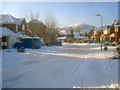
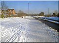
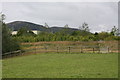
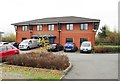
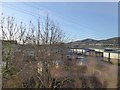

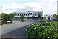
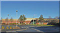
53 photos from this area
Area Information
Key information about the WR14 2UW including its size, population, and administrative classification.
- Area Type
- Postcode
- Area Size
- 1.3 hectares
- Population
- 1675
- Population Density
- 1181 people/km²
House Prices in WR14 2UW
32
Properties
£170,738
Average Sold Price
£51,850
Lowest Price
£347,000
Highest Price
Showing 32 properties
| Address | Type | Beds | Baths | Last Sale Price | Last Sale Date | |
|---|---|---|---|---|---|---|
| 20 Bramble Close, Malvern, WR14 2UW | house | 2 | 1 | £245,000 | Jul 2025 | |
| 17 Bramble Close, Malvern, WR14 2UW | Semi-detached | 2 | 1 | £235,000 | Jun 2025 | |
| 8 Bramble Close, Malvern, WR14 2UW | Detached | 4 | 2 | £300,000 | Nov 2024 | |
| 28 Bramble Close, Malvern, WR14 2UW | Semi-detached | 2 | 1 | £244,000 | Sep 2024 | |
| 22 Bramble Close, Malvern, WR14 2UW | Semi-detached | 2 | 1 | £235,000 | Sep 2022 | |
| 32 Bramble Close, Malvern, WR14 2UW | Detached | 3 | 2 | £320,000 | Aug 2022 | |
| 12 Bramble Close, Malvern, WR14 2UW | house | - | - | £347,000 | Dec 2021 | |
| 25 Bramble Close, Malvern, WR14 2UW | Detached | 3 | 2 | £265,550 | Nov 2020 | |
| 21 Bramble Close, Malvern, WR14 2UW | Semi-detached | 2 | 1 | £174,000 | Sep 2019 | |
| 7 Bramble Close, Malvern, WR14 2UW | house | - | - | £236,000 | Jul 2019 |
Page 1 of 4
Energy Efficiency in WR14 2UW
Amenities
Schools
| Rank | School | Type | Entry gender | Ages |
|---|
Explore more schools in this area
Go to Schools tabDemographics
Household Size
Two person
most common
Accommodation Type
Houses
most common
Tenure
65
majority
Ethnic Group
White
most common
Religion
N/A
most common
Household Composition
N/A
most common
Age
47
median
Adults (30-64 years)
most common
Household Deprivation
N/A
with no deprivation
NS-SEC
33
in Lower managerial occupations
Explore more demographic insights in this area
Go to Demographics tabPlanning
Planning Constraints
- Flood RiskPremium
- Ramsar Wetland SitesPremium
- Area of Outstanding Natural BeautyPremium
- Protected Nature ReservePremium
- Protected WoodlandPremium