Area Overview for WR13 6NA
Photos of WR13 6NA

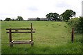
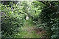


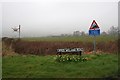
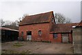

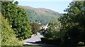
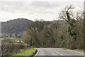
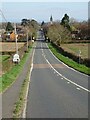
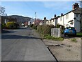
100 photos from this area
Area Information
Key information about the WR13 6NA including its size, population, and administrative classification.
- Area Type
- Postcode
- Area Size
- 81.4 hectares
- Population
- 2433
- Population Density
- 87 people/km²
House Prices in WR13 6NA
20
Properties
£500,000
Average Sold Price
£500,000
Lowest Price
£500,000
Highest Price
Showing 20 properties
| Address | Type | Beds | Baths | Last Sale Price | Last Sale Date | |
|---|---|---|---|---|---|---|
| Fleet House, Marlbank Road, Welland, WR13 6NA | Detached | 5 | 5 | £500,000 | Aug 2014 | |
| Marlbank Lodge, Marlbank Road, Welland, WR13 6NA | house | 4 | 1 | - | - | |
| Hillview, Marlbank Road, Welland, WR13 6NA | Semi-detached | 3 | 2 | - | - | |
| Owners Accommodation, Holdfast Cottage Hotel, Marlbank Road, Welland, WR13 6NA | Terraced | 11 | - | - | - | |
| Caravan And Camping Site At, Marlbank Inn, Marlbank Road, Welland, WR13 6NA | Leisure | - | - | - | - | |
| Apartment 1, Marlbank Inn, Marlbank Road, Welland, WR13 6NA | Flat | - | - | - | - | |
| Bed And Breakfast Accommodation At, Marlbank Inn, Marlbank Road, Welland, WR13 6NA | hotel | - | - | - | - | |
| Garden Cottage, Marlbank Road, Welland, WR13 6NA | Detached | - | - | - | - | |
| Ground Floor Office On The Right, Wood Farm Estate Office, Marlbank Road, Welland, WR13 6NA | Office | - | - | - | - | |
| Tennis 35M From Days Farm, Marlbank Road 35M From Unnamed Road, Marlbank Road, Welland, WR13 6NA | Leisure | - | - | - | - |
Page 1 of 2
Energy Efficiency in WR13 6NA
Amenities
Schools
| Rank | School | Type | Entry gender | Ages |
|---|
Explore more schools in this area
Go to Schools tabDemographics
Household Size
Two person
most common
Accommodation Type
Houses
most common
Tenure
79
majority
Ethnic Group
White
most common
Religion
N/A
most common
Household Composition
N/A
most common
Age
47
median
Adults (30-64 years)
most common
Household Deprivation
N/A
with no deprivation
NS-SEC
42
in Lower managerial occupations
Explore more demographic insights in this area
Go to Demographics tabPlanning
Planning Constraints
- Flood RiskPremium
- Ramsar Wetland SitesPremium
- Area of Outstanding Natural BeautyPremium
- Protected Nature ReservePremium
- Protected WoodlandPremium