Area Overview for WR12 7HZ
Photos of WR12 7HZ
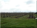
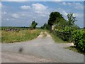
![Mount Pleasant Farm [1] in WR12 7HZ](https://images.propbar.co.uk/images/geograph/19/64/1964559_120.jpg)
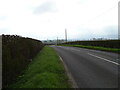
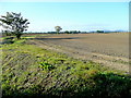
![Mount Pleasant Farm [2] in WR12 7HZ](https://images.propbar.co.uk/images/geograph/19/64/1964566_120.jpg)
19 photos from this area
Area Information
Key information about the WR12 7HZ including its size, population, and administrative classification.
- Area Type
- Postcode
- Area Size
- 1.6 km²
- Population
- 1477
- Population Density
- 116 people/km²
House Prices in WR12 7HZ
21
Properties
£466,533
Average Sold Price
£320,000
Lowest Price
£673,100
Highest Price
Showing 21 properties
| Address | Type | Beds | Baths | Last Sale Price | Last Sale Date | |
|---|---|---|---|---|---|---|
| Mount View, Hinton Road, Childswickham, WR12 7HZ | house | - | - | £406,500 | Jul 2015 | |
| Hamstel, Hinton Road, Childswickham, WR12 7HZ | house | 2 | - | £320,000 | Oct 2011 | |
| Bridleway House, Hinton Road, Childswickham, WR12 7HZ | house | - | - | £673,100 | May 2011 | |
| Avondale Self Storage, Hinton Road, Childswickham, WR12 7HZ | storage_distribution | - | - | - | - | |
| Tally Ho, Mount Pleasant Farm, Hinton Road, Childswickham, WR12 7HZ | Terraced | - | - | - | - | |
| Ascot Cottage At, Mount Pleasant Farm, Hinton Road, Childswickham, WR12 7HZ | Terraced | - | - | - | - | |
| Derby Cottage At, Mount Pleasant Farm, Hinton Road, Childswickham, WR12 7HZ | Cottage | 2 | - | - | - | |
| Epsom Cottage At, Mount Pleasant Farm, Hinton Road, Childswickham, WR12 7HZ | Cottage | 2 | - | - | - | |
| The Byre, Mount Pleasant Farm, Hinton Road, Childswickham, WR12 7HZ | Bungalow | 4 | - | - | - | |
| Aldaniti Cottage, Mount Pleasant Farm, Hinton Road, Childswickham, WR12 7HZ | Cottage | 3 | - | - | - |
Page 1 of 3
Energy Efficiency in WR12 7HZ
Amenities
Schools
| Rank | School | Type | Entry gender | Ages |
|---|
Explore more schools in this area
Go to Schools tabDemographics
Household Size
Two person
most common
Accommodation Type
Houses
most common
Tenure
78
majority
Ethnic Group
White
most common
Religion
N/A
most common
Household Composition
N/A
most common
Age
47
median
Adults (30-64 years)
most common
Household Deprivation
N/A
with no deprivation
NS-SEC
36
in Lower managerial occupations
Explore more demographic insights in this area
Go to Demographics tabPlanning
Planning Constraints
- Flood RiskPremium
- Ramsar Wetland SitesPremium
- Area of Outstanding Natural BeautyPremium
- Protected Nature ReservePremium
- Protected WoodlandPremium