Area Overview for WR12 7BH
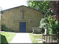
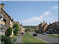
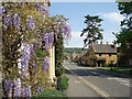
Photos of WR12 7BH
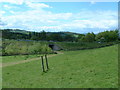
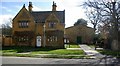
![Towards the tower [1] in WR12 7BH](https://images.propbar.co.uk/images/geograph/23/44/2344756_120.jpg)
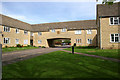
![Towards the tower [2] in WR12 7BH](https://images.propbar.co.uk/images/geograph/23/44/2344759_120.jpg)
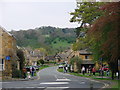
![Towards the tower [3] in WR12 7BH](https://images.propbar.co.uk/images/geograph/23/44/2344760_120.jpg)
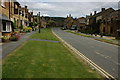
![Towards the tower [4] in WR12 7BH](https://images.propbar.co.uk/images/geograph/23/44/2344762_120.jpg)
100 photos from this area
Area Information
Key information about the WR12 7BH including its size, population, and administrative classification.
- Area Type
- Postcode
- Area Size
- 7364 m²
- Population
- 1604
- Population Density
- 1179 people/km²
House Prices in WR12 7BH
17
Properties
£217,595
Average Sold Price
£115,000
Lowest Price
£286,000
Highest Price
Showing 17 properties
| Address | Type | Beds | Baths | Last Sale Price | Last Sale Date | |
|---|---|---|---|---|---|---|
| 10 Bibsworth Avenue, Broadway, WR12 7BH | Semi-detached | 3 | 1 | £286,000 | Dec 2023 | |
| 3 Bibsworth Avenue, Broadway, WR12 7BH | Semi-detached | 3 | 1 | £275,000 | Nov 2018 | |
| 6 Bibsworth Avenue, Broadway, WR12 7BH | Semi-detached | 3 | 1 | £285,000 | Sep 2018 | |
| 9 Bibsworth Avenue, Broadway, WR12 7BH | Semi-detached | 3 | - | £280,000 | Aug 2018 | |
| 5 Bibsworth Avenue, Broadway, WR12 7BH | house | - | - | £240,000 | Oct 2015 | |
| 13 Bibsworth Avenue, Broadway, WR12 7BH | Semi-detached | 3 | - | £205,000 | Aug 2013 | |
| 15 Bibsworth Avenue, Broadway, WR12 7BH | house | 3 | - | £172,500 | May 2011 | |
| 1 Bibsworth Avenue, Broadway, WR12 7BH | house | - | - | £115,000 | Sep 2009 | |
| 11 Bibsworth Avenue, Broadway, WR12 7BH | Semi-detached | - | - | £159,950 | Aug 2007 | |
| 7 Bibsworth Avenue, Broadway, WR12 7BH | house | - | - | £157,500 | Aug 2006 |
Page 1 of 2
Energy Efficiency in WR12 7BH
Amenities
Schools
| Rank | School | Type | Entry gender | Ages |
|---|
Explore more schools in this area
Go to Schools tabDemographics
Household Size
One person
most common
Accommodation Type
Houses
most common
Tenure
58
majority
Ethnic Group
White
most common
Religion
N/A
most common
Household Composition
N/A
most common
Age
47
median
Adults (30-64 years)
most common
Household Deprivation
N/A
with no deprivation
NS-SEC
34
in Lower managerial occupations
Explore more demographic insights in this area
Go to Demographics tabPlanning
Planning Constraints
- Flood RiskPremium
- Ramsar Wetland SitesPremium
- Area of Outstanding Natural BeautyPremium
- Protected Nature ReservePremium
- Protected WoodlandPremium