Area Overview for WR11 8UU
Photos of WR11 8UU
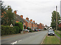
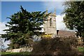
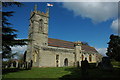

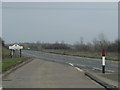

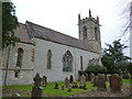


34 photos from this area
Area Information
Key information about the WR11 8UU including its size, population, and administrative classification.
- Area Type
- Postcode
- Area Size
- 42.5 hectares
- Population
- 1746
- Population Density
- 91 people/km²
House Prices in WR11 8UU
39
Properties
£308,050
Average Sold Price
£76,500
Lowest Price
£735,000
Highest Price
Showing 39 properties
| Address | Type | Beds | Baths | Last Sale Price | Last Sale Date | |
|---|---|---|---|---|---|---|
| Vine Cottage, Evesham Road, Salford Priors, WR11 8UU | Detached | 4 | 2 | £390,000 | Jan 2025 | |
| Beaumont House, Evesham Road, Salford Priors, WR11 8UU | Detached | 5 | 3 | £735,000 | Mar 2024 | |
| Shamba, Evesham Road, Salford Priors, WR11 8UU | Bungalow | - | - | £660,000 | Feb 2024 | |
| 4, Meadow View, Evesham Road, Salford Priors, WR11 8UU | Terraced | 4 | 3 | £198,000 | Nov 2022 | |
| St Germaines, Evesham Road, Salford Priors, WR11 8UU | house | - | - | £235,000 | Sep 2021 | |
| Victoria Cottage, Evesham Road, Salford Priors, WR11 8UU | Detached | 3 | 2 | £334,000 | May 2021 | |
| Willow House, Evesham Road, Salford Priors, WR11 8UU | Terraced | 3 | 1 | £235,000 | Sep 2020 | |
| Mistelle, Evesham Road, Salford Priors, WR11 8UU | Detached | - | - | £250,000 | May 2020 | |
| Newlands, Evesham Road, Salford Priors, WR11 8UU | house | - | - | £360,000 | Oct 2019 | |
| Little Orchard, Evesham Road, Salford Priors, WR11 8UU | Detached | 4 | 3 | £390,000 | Sep 2019 |
Page 1 of 4
Energy Efficiency in WR11 8UU
Amenities
Schools
| Rank | School | Type | Entry gender | Ages |
|---|
Explore more schools in this area
Go to Schools tabDemographics
Household Size
Two person
most common
Accommodation Type
Houses
most common
Tenure
70
majority
Ethnic Group
White
most common
Religion
N/A
most common
Household Composition
N/A
most common
Age
47
median
Adults (30-64 years)
most common
Household Deprivation
N/A
with no deprivation
NS-SEC
36
in Lower managerial occupations
Explore more demographic insights in this area
Go to Demographics tabPlanning
Planning Constraints
- Flood RiskPremium
- Ramsar Wetland SitesPremium
- Area of Outstanding Natural BeautyPremium
- Protected Nature ReservePremium
- Protected WoodlandPremium