Area Overview for WR11 8NZ
Photos of WR11 8NZ
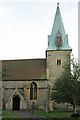
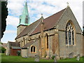
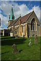
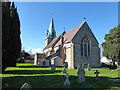
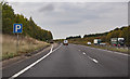
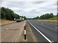
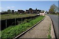
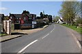
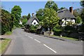
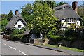
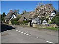
65 photos from this area
Area Information
Key information about the WR11 8NZ including its size, population, and administrative classification.
- Area Type
- Postcode
- Area Size
- 10.3 hectares
- Population
- 1381
- Population Density
- 366 people/km²
House Prices in WR11 8NZ
66
Properties
£205,035
Average Sold Price
£60,000
Lowest Price
£477,500
Highest Price
Showing 66 properties
| Address | Type | Beds | Baths | Last Sale Price | Last Sale Date | |
|---|---|---|---|---|---|---|
| 40 Hughes Close, Harvington, WR11 8NZ | Detached | 4 | 2 | £425,000 | Oct 2025 | |
| 32 Hughes Close, Harvington, WR11 8NZ | house | 4 | 2 | £430,000 | Jun 2024 | |
| 55 Hughes Close, Harvington, WR11 8NZ | Detached | 4 | 2 | £477,500 | Oct 2022 | |
| 54 Hughes Close, Harvington, WR11 8NZ | house | 3 | - | £294,500 | Dec 2021 | |
| 11 Hughes Close, Harvington, WR11 8NZ | house | - | - | £280,000 | Jun 2021 | |
| 39 Hughes Close, Harvington, WR11 8NZ | house | - | - | £236,000 | Nov 2020 | |
| 52 Hughes Close, Harvington, WR11 8NZ | Detached | 3 | 1 | £257,000 | Jan 2020 | |
| 44 Hughes Close, Harvington, WR11 8NZ | Detached | 4 | 2 | £255,000 | Sep 2019 | |
| 15 Hughes Close, Harvington, WR11 8NZ | Semi-detached | 3 | - | £230,000 | Aug 2019 | |
| 57 Hughes Close, Harvington, WR11 8NZ | Detached | 3 | 1 | £242,500 | Feb 2019 |
Page 1 of 7
Energy Efficiency in WR11 8NZ
Amenities
Schools
| Rank | School | Type | Entry gender | Ages |
|---|
Explore more schools in this area
Go to Schools tabDemographics
Household Size
Two person
most common
Accommodation Type
Houses
most common
Tenure
83
majority
Ethnic Group
White
most common
Religion
N/A
most common
Household Composition
N/A
most common
Age
47
median
Adults (30-64 years)
most common
Household Deprivation
N/A
with no deprivation
NS-SEC
41
in Lower managerial occupations
Explore more demographic insights in this area
Go to Demographics tabPlanning
Planning Constraints
- Flood RiskPremium
- Ramsar Wetland SitesPremium
- Area of Outstanding Natural BeautyPremium
- Protected Nature ReservePremium
- Protected WoodlandPremium