Area Overview for WR11 7XF
Photos of WR11 7XF
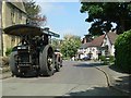

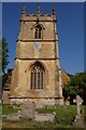

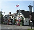

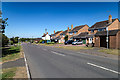
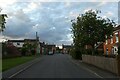
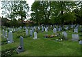
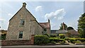
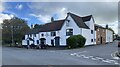
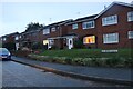
34 photos from this area
Area Information
Key information about the WR11 7XF including its size, population, and administrative classification.
- Area Type
- Postcode
- Area Size
- 1.5 hectares
- Population
- 1908
- Population Density
- 669 people/km²
House Prices in WR11 7XF
35
Properties
£246,923
Average Sold Price
£75,000
Lowest Price
£355,000
Highest Price
Showing 35 properties
| Address | Type | Beds | Baths | Last Sale Price | Last Sale Date | |
|---|---|---|---|---|---|---|
| 27 Old Post Office Lane, Badsey, WR11 7XF | Semi-detached | 2 | 1 | £163,500 | Aug 2018 | |
| 23 Old Post Office Lane, Badsey, WR11 7XF | house | 3 | 2 | £350,000 | May 2018 | |
| 15 Old Post Office Lane, Badsey, WR11 7XF | house | 3 | 1 | £275,000 | Jul 2016 | |
| Beech House, 6A Old Post Office Lane, Badsey, WR11 7XF | Detached | 4 | - | £345,000 | May 2015 | |
| 20 Old Post Office Lane, Badsey, WR11 7XF | Semi-detached | 3 | - | £174,500 | Mar 2015 | |
| 24 Old Post Office Lane, Badsey, WR11 7XF | Semi-detached | 3 | - | £230,000 | Apr 2014 | |
| 6 Old Post Office Lane, Badsey, WR11 7XF | Detached | 3 | 1 | £330,000 | Jun 2012 | |
| Birch House, 6B Old Post Office Lane, Badsey, WR11 7XF | Detached | - | - | £350,000 | Mar 2012 | |
| 1 Old Post Office Lane, Badsey, WR11 7XF | house | 5 | - | £355,000 | Jul 2011 | |
| 14 Old Post Office Lane, Badsey, WR11 7XF | Detached | - | - | £267,000 | Jul 2007 |
Page 1 of 4
Energy Efficiency in WR11 7XF
Amenities
Schools
| Rank | School | Type | Entry gender | Ages |
|---|
Explore more schools in this area
Go to Schools tabDemographics
Household Size
Two person
most common
Accommodation Type
Houses
most common
Tenure
67
majority
Ethnic Group
White
most common
Religion
N/A
most common
Household Composition
N/A
most common
Age
47
median
Adults (30-64 years)
most common
Household Deprivation
N/A
with no deprivation
NS-SEC
31
in Lower managerial occupations
Explore more demographic insights in this area
Go to Demographics tabPlanning
Planning Constraints
- Flood RiskPremium
- Ramsar Wetland SitesPremium
- Area of Outstanding Natural BeautyPremium
- Protected Nature ReservePremium
- Protected WoodlandPremium