Area Overview for WR11 7XB
Photos of WR11 7XB
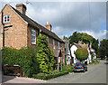
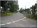
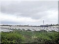
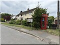
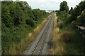
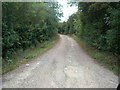
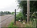
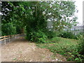


15 photos from this area
Area Information
Key information about the WR11 7XB including its size, population, and administrative classification.
- Area Type
- Postcode
- Area Size
- 24.2 hectares
- Population
- 1908
- Population Density
- 669 people/km²
House Prices in WR11 7XB
32
Properties
£360,684
Average Sold Price
£94,000
Lowest Price
£680,000
Highest Price
Showing 32 properties
| Address | Type | Beds | Baths | Last Sale Price | Last Sale Date | |
|---|---|---|---|---|---|---|
| Butterlay House, Main Street, Aldington, WR11 7XB | Detached | 4 | 3 | £595,000 | Dec 2021 | |
| Corner House, Main Street, Aldington, WR11 7XB | house | 4 | 2 | £385,000 | Sep 2020 | |
| The Old Stables, Main Street, Aldington, WR11 7XB | Bungalow | - | - | £282,500 | Dec 2019 | |
| Middle Bank, Main Street, Aldington, WR11 7XB | house | - | - | £400,000 | Nov 2019 | |
| The Old Cider Mill, Main Street, Aldington, WR11 7XB | Semi-detached | 4 | - | £350,000 | Jun 2019 | |
| Beeholme, Main Street, Aldington, WR11 7XB | house | - | - | £680,000 | Apr 2019 | |
| Half Acre, Main Street, Aldington, WR11 7XB | house | - | - | £520,500 | Mar 2018 | |
| The Swallows, Main Street, Aldington, WR11 7XB | Detached | 3 | - | £445,000 | Jul 2017 | |
| Mellowstone, Main Street, Aldington, WR11 7XB | Bungalow | 4 | 1 | £297,500 | Nov 2016 | |
| Vale View, Main Street, Aldington, WR11 7XB | Detached | 4 | - | £352,000 | Sep 2015 |
Page 1 of 4
Energy Efficiency in WR11 7XB
Amenities
Schools
| Rank | School | Type | Entry gender | Ages |
|---|
Explore more schools in this area
Go to Schools tabDemographics
Household Size
Two person
most common
Accommodation Type
Houses
most common
Tenure
67
majority
Ethnic Group
White
most common
Religion
N/A
most common
Household Composition
N/A
most common
Age
47
median
Adults (30-64 years)
most common
Household Deprivation
N/A
with no deprivation
NS-SEC
31
in Lower managerial occupations
Explore more demographic insights in this area
Go to Demographics tabPlanning
Planning Constraints
- Flood RiskPremium
- Ramsar Wetland SitesPremium
- Area of Outstanding Natural BeautyPremium
- Protected Nature ReservePremium
- Protected WoodlandPremium