Area Overview for WR11 7TE
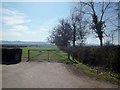
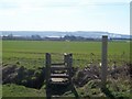
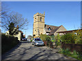
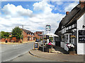
Photos of WR11 7TE
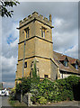
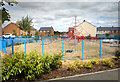
![Cow Honeybourne church [1] in WR11 7TE](https://images.propbar.co.uk/images/geograph/23/56/2356702_120.jpg)
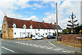
![Cow Honeybourne church [2] in WR11 7TE](https://images.propbar.co.uk/images/geograph/23/56/2356704_120.jpg)
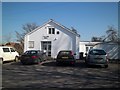
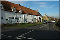
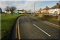
55 photos from this area
Area Information
Key information about the WR11 7TE including its size, population, and administrative classification.
- Area Type
- Postcode
- Area Size
- 5.5 hectares
- Population
- 1694
- Population Density
- 67 people/km²
House Prices in WR11 7TE
33
Properties
£310,630
Average Sold Price
£147,746
Lowest Price
£465,000
Highest Price
Showing 33 properties
| Address | Type | Beds | Baths | Last Sale Price | Last Sale Date | |
|---|---|---|---|---|---|---|
| 55 Fallow Field, Honeybourne, WR11 7TE | Terraced | 2 | 1 | £172,500 | Oct 2025 | |
| 37 Fallow Field, Honeybourne, WR11 7TE | house | - | - | £238,000 | Aug 2024 | |
| 33 Fallow Field, Honeybourne, WR11 7TE | Terraced | 3 | 2 | £274,000 | Oct 2023 | |
| 51 Fallow Field, Honeybourne, WR11 7TE | Terraced | 2 | 1 | £183,750 | Aug 2023 | |
| 43 Fallow Field, Honeybourne, WR11 7TE | Terraced | 3 | 2 | £289,000 | Aug 2023 | |
| 9 Fallow Field, Honeybourne, WR11 7TE | Detached | 4 | 2 | £400,000 | Aug 2023 | |
| 45 Fallow Field, Honeybourne, WR11 7TE | house | - | - | £260,000 | Jun 2023 | |
| 53 Fallow Field, Honeybourne, WR11 7TE | Retail | 2 | 2 | £183,750 | Oct 2022 | |
| 41 Fallow Field, Honeybourne, WR11 7TE | house | - | - | £270,000 | Sep 2021 | |
| 39 Fallow Field, Honeybourne, WR11 7TE | house | - | - | £250,000 | Jan 2021 |
Page 1 of 4
Energy Efficiency in WR11 7TE
Amenities
Schools
| Rank | School | Type | Entry gender | Ages |
|---|
Explore more schools in this area
Go to Schools tabDemographics
Household Size
Two person
most common
Accommodation Type
Houses
most common
Tenure
75
majority
Ethnic Group
White
most common
Religion
N/A
most common
Household Composition
N/A
most common
Age
47
median
Adults (30-64 years)
most common
Household Deprivation
N/A
with no deprivation
NS-SEC
38
in Lower managerial occupations
Explore more demographic insights in this area
Go to Demographics tabPlanning
Planning Constraints
- Flood RiskPremium
- Ramsar Wetland SitesPremium
- Area of Outstanding Natural BeautyPremium
- Protected Nature ReservePremium
- Protected WoodlandPremium