Area Overview for WR11 7QG
Photos of WR11 7QG
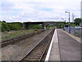

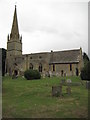
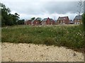
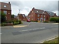
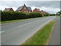

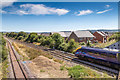
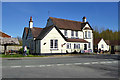
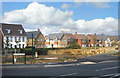
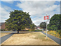
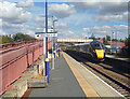
71 photos from this area
Area Information
Key information about the WR11 7QG including its size, population, and administrative classification.
- Area Type
- Postcode
- Area Size
- 21.6 hectares
- Population
- 1356
- Population Density
- 571 people/km²
House Prices in WR11 7QG
33
Properties
£335,725
Average Sold Price
£105,000
Lowest Price
£725,000
Highest Price
Showing 33 properties
| Address | Type | Beds | Baths | Last Sale Price | Last Sale Date | |
|---|---|---|---|---|---|---|
| Jackdaws, Station Road, Honeybourne, WR11 7QG | house | - | - | £595,000 | Aug 2022 | |
| Reculver, 2 Station Road, Honeybourne, WR11 7QG | Detached | 6 | - | £500,000 | Aug 2022 | |
| Oaklea, Station Road, Honeybourne, WR11 7QG | Bungalow | - | - | £185,000 | May 2021 | |
| 1, Brandon Villas, Station Road, Honeybourne, WR11 7QG | Detached | 6 | 4 | £325,000 | Dec 2020 | |
| The Birches, Station Road, Honeybourne, WR11 7QG | Detached | 6 | 4 | £725,000 | Jun 2020 | |
| St Mabyn, Station Road, Honeybourne, WR11 7QG | house | - | - | £480,000 | Dec 2019 | |
| Honeybourne House, Station Road, Honeybourne, WR11 7QG | Detached | 5 | 2 | £530,000 | Sep 2017 | |
| Cornwall Villa, Station Road, Honeybourne, WR11 7QG | house | - | - | £300,000 | Jul 2015 | |
| Hazel House, Station Road, Honeybourne, WR11 7QG | Detached | 4 | - | £411,101 | Oct 2013 | |
| Wychwood, Station Road, Honeybourne, WR11 7QG | house | - | - | £250,000 | Nov 2009 |
Page 1 of 4
Energy Efficiency in WR11 7QG
Amenities
Schools
| Rank | School | Type | Entry gender | Ages |
|---|
Explore more schools in this area
Go to Schools tabDemographics
Household Size
Two person
most common
Accommodation Type
Houses
most common
Tenure
68
majority
Ethnic Group
White
most common
Religion
N/A
most common
Household Composition
N/A
most common
Age
47
median
Adults (30-64 years)
most common
Household Deprivation
N/A
with no deprivation
NS-SEC
31
in Lower managerial occupations
Explore more demographic insights in this area
Go to Demographics tabPlanning
Planning Constraints
- Flood RiskPremium
- Ramsar Wetland SitesPremium
- Area of Outstanding Natural BeautyPremium
- Protected Nature ReservePremium
- Protected WoodlandPremium