Area Overview for WR11 4UQ
Photos of WR11 4UQ
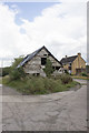
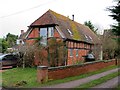
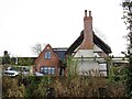
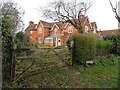
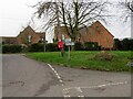
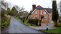
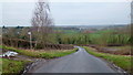
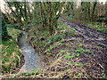
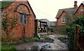
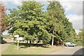
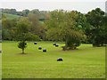
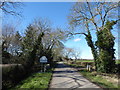
14 photos from this area
Area Information
Key information about the WR11 4UQ including its size, population, and administrative classification.
- Area Type
- Postcode
- Area Size
- 78.3 hectares
- Population
- 1214
- Population Density
- 41 people/km²
House Prices in WR11 4UQ
13
Properties
£506,667
Average Sold Price
£340,000
Lowest Price
£650,000
Highest Price
Showing 13 properties
| Address | Type | Beds | Baths | Last Sale Price | Last Sale Date | |
|---|---|---|---|---|---|---|
| Wychwood, Ab Lench Road, Abbots Lench, Church Lench, WR11 4UQ | Detached | - | - | £340,000 | Aug 2020 | |
| Oakwood, Ab Lench Road, Abbots Lench, Church Lench, WR11 4UQ | Detached | 5 | 2 | £530,000 | Jul 2018 | |
| Old Rectory, Ab Lench Road, Abbots Lench, Church Lench, WR11 4UQ | Detached | - | - | £650,000 | Nov 2005 | |
| Farriers Barn, Farriers Court, Ab Lench Road, Abbots Lench, Church Lench, WR11 4UQ | Detached | 3 | 2 | - | - | |
| The Bungalow, Ab Lench Road, Abbots Lench, Church Lench, WR11 4UQ | undefined | - | - | - | - | |
| Caravan At, Rookery Farm, Ab Lench Road, Abbots Lench, WR11 4UQ | Detached | - | - | - | - | |
| The Flat, Rookery Farm, Ab Lench Road, Abbots Lench, WR11 4UQ | Flat | - | - | - | - | |
| Tennis 105M From Old Rectory, Ab Lench Road 53M From Ab Lench Road, Ab Lench Road, Abbots Lench, Church Lench, WR11 4UQ | Leisure | - | - | - | - | |
| Tennis 83M From Old Rectory, Ab Lench Road 26M From Ab Lench Road, Ab Lench Road, Abbots Lench, Church Lench, WR11 4UQ | Leisure | - | - | - | - | |
| Rookery Farm, Ab Lench Road, Abbots Lench, WR11 4UQ | Detached | - | - | - | - |
Page 1 of 2
Energy Efficiency in WR11 4UQ
Amenities
Schools
| Rank | School | Type | Entry gender | Ages |
|---|
Explore more schools in this area
Go to Schools tabDemographics
Household Size
Two person
most common
Accommodation Type
Houses
most common
Tenure
84
majority
Ethnic Group
White
most common
Religion
N/A
most common
Household Composition
N/A
most common
Age
47
median
Adults (30-64 years)
most common
Household Deprivation
N/A
with no deprivation
NS-SEC
44
in Lower managerial occupations
Explore more demographic insights in this area
Go to Demographics tabPlanning
Planning Constraints
- Flood RiskPremium
- Ramsar Wetland SitesPremium
- Area of Outstanding Natural BeautyPremium
- Protected Nature ReservePremium
- Protected WoodlandPremium